Saint-Aubin, Jura
| Saint-Aubin | |
|---|---|
 | |
 Saint-Aubin | |
|
Location within Bourgogne-Franche-Comté region  Saint-Aubin | |
| Coordinates: 47°01′59″N 5°19′52″E / 47.0331°N 5.3311°ECoordinates: 47°01′59″N 5°19′52″E / 47.0331°N 5.3311°E | |
| Country | France |
| Region | Bourgogne-Franche-Comté |
| Department | Jura |
| Arrondissement | Dole |
| Canton | Chemin |
| Government | |
| • Mayor (2014–2020) | Claude François |
| Area1 | 33.76 km2 (13.03 sq mi) |
| Population (2013)2 | 1,779 |
| • Density | 53/km2 (140/sq mi) |
| Time zone | CET (UTC+1) |
| • Summer (DST) | CEST (UTC+2) |
| INSEE/Postal code | 39476 / 39410 |
| Elevation | 180–192 m (591–630 ft) |
|
1 French Land Register data, which excludes lakes, ponds, glaciers > 1 km² (0.386 sq mi or 247 acres) and river estuaries. 2 Population without double counting: residents of multiple communes (e.g., students and military personnel) only counted once. | |
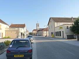
Saint-Aubin is a village and commune in the Jura department in the Bourgogne-Franche-Comté region in eastern France.
Population
| Historical population | ||
|---|---|---|
| Year | Pop. | ±% |
| 1793 | 1,490 | — |
| 1806 | 1,364 | −8.5% |
| 1821 | 1,586 | +16.3% |
| 1831 | 1,559 | −1.7% |
| 1841 | 1,699 | +9.0% |
| 1851 | 1,795 | +5.7% |
| 1861 | 1,671 | −6.9% |
| 1872 | 1,568 | −6.2% |
| 1881 | 1,520 | −3.1% |
| 1891 | 1,457 | −4.1% |
| 1901 | 1,406 | −3.5% |
| 1911 | 1,382 | −1.7% |
| 1921 | 1,139 | −17.6% |
| 1931 | 1,177 | +3.3% |
| 1946 | 1,134 | −3.7% |
| 1954 | 1,266 | +11.6% |
| 1962 | 1,353 | +6.9% |
| 1968 | 1,471 | +8.7% |
| 1975 | 1,557 | +5.8% |
| 1982 | 1,544 | −0.8% |
| 1990 | 1,520 | −1.6% |
| 1999 | 1,539 | +1.2% |
| 2008 | 1,737 | +12.9% |
| 2013 | 1,779 | +2.4% |
See also
References
| Wikimedia Commons has media related to Saint-Aubin (Jura). |
This article is issued from Wikipedia - version of the 2/10/2016. The text is available under the Creative Commons Attribution/Share Alike but additional terms may apply for the media files.