La Pesse
| La Pesse | ||
|---|---|---|
|
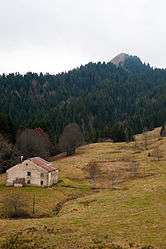
Crêt de Chalam | ||
| ||
 La Pesse | ||
|
Location within Bourgogne-Franche-Comté region  La Pesse | ||
| Coordinates: 46°17′11″N 5°50′54″E / 46.2864°N 5.8483°ECoordinates: 46°17′11″N 5°50′54″E / 46.2864°N 5.8483°E | ||
| Country | France | |
| Region | Bourgogne-Franche-Comté | |
| Department | Jura | |
| Arrondissement | Saint-Claude | |
| Canton | Les Bouchoux | |
| Government | ||
| • Mayor (2014–2020) | Francis Moricheau | |
| Area1 | 24.26 km2 (9.37 sq mi) | |
| Population (2012)2 | 343 | |
| • Density | 14/km2 (37/sq mi) | |
| Time zone | CET (UTC+1) | |
| • Summer (DST) | CEST (UTC+2) | |
| INSEE/Postal code | 39413 / 39370 | |
| Elevation | 800–1,440 m (2,620–4,720 ft) | |
|
1 French Land Register data, which excludes lakes, ponds, glaciers > 1 km² (0.386 sq mi or 247 acres) and river estuaries. 2 Population without double counting: residents of multiple communes (e.g., students and military personnel) only counted once. | ||
.svg.png)
La Pesse is a commune in the Jura department in Franche-Comté in eastern France.
Population
| Historical population | ||
|---|---|---|
| Year | Pop. | ±% |
| 1836 | 966 | — |
| 1841 | 904 | −6.4% |
| 1851 | 897 | −0.8% |
| 1861 | 907 | +1.1% |
| 1872 | 871 | −4.0% |
| 1881 | 813 | −6.7% |
| 1891 | 796 | −2.1% |
| 1901 | 520 | −34.7% |
| 1911 | 663 | +27.5% |
| 1921 | 589 | −11.2% |
| 1931 | 515 | −12.6% |
| 1946 | 419 | −18.6% |
| 1965 | 384 | −8.4% |
| 1962 | 324 | −15.6% |
| 1968 | 275 | −15.1% |
| 1975 | 210 | −23.6% |
| 1982 | 232 | +10.5% |
| 1990 | 245 | +5.6% |
| 1999 | 263 | +7.3% |
| 2006 | 326 | +24.0% |
| 2012 | 343 | +5.2% |
See also
References
| Wikimedia Commons has media related to La Pesse. |
This article is issued from Wikipedia - version of the 3/15/2016. The text is available under the Creative Commons Attribution/Share Alike but additional terms may apply for the media files.