Chemin, Jura
This article is about the commune. For other uses, see Chemin de fer.
| Chemin | ||
|---|---|---|
 | ||
| ||
 Chemin | ||
|
Location within Bourgogne-Franche-Comté region  Chemin | ||
| Coordinates: 46°58′52″N 5°19′01″E / 46.9811°N 5.3169°ECoordinates: 46°58′52″N 5°19′01″E / 46.9811°N 5.3169°E | ||
| Country | France | |
| Region | Bourgogne-Franche-Comté | |
| Department | Jura | |
| Arrondissement | Dole | |
| Canton | Chemin | |
| Government | ||
| • Mayor (2014–2020) | Annie Jobelin | |
| Area1 | 9.14 km2 (3.53 sq mi) | |
| Population (2012)2 | 342 | |
| • Density | 37/km2 (97/sq mi) | |
| Time zone | CET (UTC+1) | |
| • Summer (DST) | CEST (UTC+2) | |
| INSEE/Postal code | 39138 / 39120 | |
| Elevation | 182–188 m (597–617 ft) | |
|
1 French Land Register data, which excludes lakes, ponds, glaciers > 1 km² (0.386 sq mi or 247 acres) and river estuaries. 2 Population without double counting: residents of multiple communes (e.g., students and military personnel) only counted once. | ||

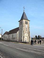
Chemin is a commune in the Jura department in Franche-Comté in eastern France.
Population
| Historical population | ||
|---|---|---|
| Year | Pop. | ±% |
| 1793 | 214 | — |
| 1806 | 225 | +5.1% |
| 1821 | 215 | −4.4% |
| 1831 | 456 | +112.1% |
| 1841 | 448 | −1.8% |
| 1851 | 483 | +7.8% |
| 1861 | 440 | −8.9% |
| 1872 | 404 | −8.2% |
| 1881 | 417 | +3.2% |
| 1891 | 409 | −1.9% |
| 1901 | 374 | −8.6% |
| 1911 | 360 | −3.7% |
| 1921 | 286 | −20.6% |
| 1931 | 294 | +2.8% |
| 1946 | 258 | −12.2% |
| 1954 | 270 | +4.7% |
| 1962 | 295 | +9.3% |
| 1968 | 317 | +7.5% |
| 1975 | 294 | −7.3% |
| 1982 | 333 | +13.3% |
| 1990 | 383 | +15.0% |
| 1999 | 380 | −0.8% |
| 2006 | 358 | −5.8% |
| 2012 | 342 | −4.5% |
See also
References
| Wikimedia Commons has media related to Chemin (Jura). |
This article is issued from Wikipedia - version of the 4/29/2015. The text is available under the Creative Commons Attribution/Share Alike but additional terms may apply for the media files.