Chemenot
| Chemenot | |
|---|---|
|
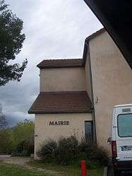
Town hall | |
 Chemenot | |
|
Location within Bourgogne-Franche-Comté region  Chemenot | |
| Coordinates: 46°52′04″N 5°32′04″E / 46.8678°N 5.5344°ECoordinates: 46°52′04″N 5°32′04″E / 46.8678°N 5.5344°E | |
| Country | France |
| Region | Bourgogne-Franche-Comté |
| Department | Jura |
| Arrondissement | Lons-le-Saunier |
| Canton | Poligny |
| Government | |
| • Mayor (2014–2020) | Serge Grévy |
| Area1 | 4.74 km2 (1.83 sq mi) |
| Population (2012)2 | 36 |
| • Density | 7.6/km2 (20/sq mi) |
| Time zone | CET (UTC+1) |
| • Summer (DST) | CEST (UTC+2) |
| INSEE/Postal code | 39136 / 39230 |
| Elevation | 203–227 m (666–745 ft) |
|
1 French Land Register data, which excludes lakes, ponds, glaciers > 1 km² (0.386 sq mi or 247 acres) and river estuaries. 2 Population without double counting: residents of multiple communes (e.g., students and military personnel) only counted once. | |
Chemenot is a commune in the Jura department in Franche-Comté in eastern France.
Population
| Historical population | ||
|---|---|---|
| Year | Pop. | ±% |
| 1793 | 154 | — |
| 1806 | 131 | −14.9% |
| 1821 | 157 | +19.8% |
| 1831 | 169 | +7.6% |
| 1841 | 221 | +30.8% |
| 1851 | 213 | −3.6% |
| 1861 | 219 | +2.8% |
| 1872 | 216 | −1.4% |
| 1881 | 210 | −2.8% |
| 1891 | 197 | −6.2% |
| 1901 | 149 | −24.4% |
| 1911 | 165 | +10.7% |
| 1921 | 135 | −18.2% |
| 1931 | 109 | −19.3% |
| 1946 | 89 | −18.3% |
| 1954 | 82 | −7.9% |
| 1962 | 57 | −30.5% |
| 1968 | 47 | −17.5% |
| 1975 | 60 | +27.7% |
| 1982 | 48 | −20.0% |
| 1990 | 41 | −14.6% |
| 1999 | 35 | −14.6% |
| 2006 | 39 | +11.4% |
| 2012 | 36 | −7.7% |
See also
References
| Wikimedia Commons has media related to Chemenot. |
This article is issued from Wikipedia - version of the 4/16/2016. The text is available under the Creative Commons Attribution/Share Alike but additional terms may apply for the media files.