Grailhen
| Grailhen | ||
|---|---|---|
|
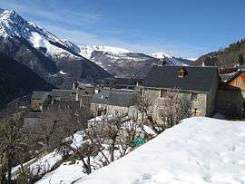
A view of the village | ||
| ||
 Grailhen | ||
|
Location within Occitanie region  Grailhen | ||
| Coordinates: 42°50′51″N 0°21′44″E / 42.8475°N 0.3622°ECoordinates: 42°50′51″N 0°21′44″E / 42.8475°N 0.3622°E | ||
| Country | France | |
| Region | Occitanie | |
| Department | Hautes-Pyrénées | |
| Arrondissement | Arrondissement of Bagnères-de-Bigorre | |
| Canton | Canton of Vielle-Aure | |
| Intercommunality | Communauté de communes de la Haute Vallée d'Aure | |
| Area1 | 6.06 km2 (2.34 sq mi) | |
| Population (1999)2 | 12 | |
| • Density | 2.0/km2 (5.1/sq mi) | |
| Time zone | CET (UTC+1) | |
| • Summer (DST) | CEST (UTC+2) | |
| INSEE/Postal code | 65208 / 65170 | |
| Elevation |
1,000–1,728 m (3,281–5,669 ft) (avg. 1,110 m or 3,640 ft) | |
|
1 French Land Register data, which excludes lakes, ponds, glaciers > 1 km² (0.386 sq mi or 247 acres) and river estuaries. 2 Population without double counting: residents of multiple communes (e.g., students and military personnel) only counted once. | ||
.svg.png)
Grailhen is a commune in the Hautes-Pyrénées department in south-western France.
See also
References
| Wikimedia Commons has media related to Grailhen. |
This article is issued from Wikipedia - version of the 7/14/2014. The text is available under the Creative Commons Attribution/Share Alike but additional terms may apply for the media files.