Roche-lès-Clerval
| Roche-lès-Clerval | ||
|---|---|---|
|
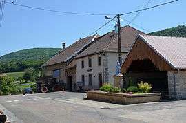
Town hall | ||
| ||
 Roche-lès-Clerval | ||
|
Location within Bourgogne-Franche-Comté region  Roche-lès-Clerval | ||
| Coordinates: 47°22′06″N 6°28′55″E / 47.3683°N 6.4819°ECoordinates: 47°22′06″N 6°28′55″E / 47.3683°N 6.4819°E | ||
| Country | France | |
| Region | Bourgogne-Franche-Comté | |
| Department | Doubs | |
| Arrondissement | Montbéliard | |
| Canton | Clerval | |
| Government | ||
| • Mayor (2008–2014) | Jérôme Guillod | |
| Area1 | 5.34 km2 (2.06 sq mi) | |
| Population (2012)2 | 115 | |
| • Density | 22/km2 (56/sq mi) | |
| Time zone | CET (UTC+1) | |
| • Summer (DST) | CEST (UTC+2) | |
| INSEE/Postal code | 25496 / 25340 | |
| Elevation | 272–558 m (892–1,831 ft) | |
|
1 French Land Register data, which excludes lakes, ponds, glaciers > 1 km² (0.386 sq mi or 247 acres) and river estuaries. 2 Population without double counting: residents of multiple communes (e.g., students and military personnel) only counted once. | ||

Roche-lès-Clerval is a commune in the Doubs department in the Bourgogne-Franche-Comté region in eastern France.
Geography
The commune lies 4 km (2.5 mi) south of Clerval at the foot of the Lomont peak on the bank of the Doubs River.
Population
| Historical population | ||
|---|---|---|
| Year | Pop. | ±% |
| 1962 | 98 | — |
| 1968 | 107 | +9.2% |
| 1975 | 99 | −7.5% |
| 1982 | 87 | −12.1% |
| 1990 | 93 | +6.9% |
| 1999 | 93 | +0.0% |
| 2008 | 97 | +4.3% |
| 2012 | 115 | +18.6% |
See also
References
External links
| Wikimedia Commons has media related to Roche-lès-Clerval. |
This article is issued from Wikipedia - version of the 10/29/2016. The text is available under the Creative Commons Attribution/Share Alike but additional terms may apply for the media files.