Brognard
| Brognard | ||
|---|---|---|
|
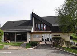
Town hall | ||
| ||
 Brognard | ||
|
Location within Bourgogne-Franche-Comté region  Brognard | ||
| Coordinates: 47°31′51″N 6°51′54″E / 47.5308°N 6.865°ECoordinates: 47°31′51″N 6°51′54″E / 47.5308°N 6.865°E | ||
| Country | France | |
| Region | Bourgogne-Franche-Comté | |
| Department | Doubs | |
| Arrondissement | Montbéliard | |
| Canton | Étupes | |
| Intercommunality | Pays de Montbéliard | |
| Government | ||
| • Mayor (2008–2014) | Michel Kipfer | |
| Area1 | 2.9 km2 (1.1 sq mi) | |
| Population (2012)2 | 456 | |
| • Density | 160/km2 (410/sq mi) | |
| Time zone | CET (UTC+1) | |
| • Summer (DST) | CEST (UTC+2) | |
| INSEE/Postal code | 25097 / 25600 | |
| Elevation | 319–383 m (1,047–1,257 ft) | |
|
1 French Land Register data, which excludes lakes, ponds, glaciers > 1 km² (0.386 sq mi or 247 acres) and river estuaries. 2 Population without double counting: residents of multiple communes (e.g., students and military personnel) only counted once. | ||

Brognard is a commune in the Doubs department in the Bourgogne-Franche-Comté region in eastern France.
Population
| Historical population | ||
|---|---|---|
| Year | Pop. | ±% |
| 1962 | 228 | — |
| 1968 | 254 | +11.4% |
| 1975 | 228 | −10.2% |
| 1982 | 275 | +20.6% |
| 1990 | 424 | +54.2% |
| 1999 | 417 | −1.7% |
| 2008 | 444 | +6.5% |
| 2012 | 456 | +2.7% |
See also
References
External links
| Wikimedia Commons has media related to Brognard. |
- Pays de Montbéliard website (French)
This article is issued from Wikipedia - version of the 11/9/2016. The text is available under the Creative Commons Attribution/Share Alike but additional terms may apply for the media files.