Saint-Vit
| Saint-Vit | |
|---|---|
|
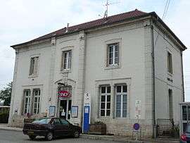
Train station | |
 Saint-Vit | |
|
Location within Bourgogne-Franche-Comté region  Saint-Vit | |
| Coordinates: 47°10′56″N 5°48′41″E / 47.1822°N 5.8114°ECoordinates: 47°10′56″N 5°48′41″E / 47.1822°N 5.8114°E | |
| Country | France |
| Region | Bourgogne-Franche-Comté |
| Department | Doubs |
| Arrondissement | Besançon |
| Canton | Boussières |
| Intercommunality | Val Saint-Vitois |
| Government | |
| • Mayor (2008–2014) | Pascal Routhier |
| Area1 | 16.44 km2 (6.35 sq mi) |
| Population (2012)2 | 4,819 |
| • Density | 290/km2 (760/sq mi) |
| Time zone | CET (UTC+1) |
| • Summer (DST) | CEST (UTC+2) |
| INSEE/Postal code | 25527 / 25410 |
| Elevation | 210–302 m (689–991 ft) |
|
1 French Land Register data, which excludes lakes, ponds, glaciers > 1 km² (0.386 sq mi or 247 acres) and river estuaries. 2 Population without double counting: residents of multiple communes (e.g., students and military personnel) only counted once. | |
Saint-Vit is a commune in the Doubs département in the Bourgogne-Franche-Comté region in eastern France.
Geography
The town lies 11 km (6.8 mi) northwest of Boussières.
Population
| Historical population | ||
|---|---|---|
| Year | Pop. | ±% |
| 1962 | 1,395 | — |
| 1968 | 1,579 | +13.2% |
| 1975 | 2,152 | +36.3% |
| 1982 | 2,978 | +38.4% |
| 1990 | 3,774 | +26.7% |
| 1999 | 4,381 | +16.1% |
| 2008 | 4,642 | +6.0% |
| 2012 | 4,819 | +3.8% |
See also
References
External links
| Wikimedia Commons has media related to Saint-Vit. |
- Saint-Vit on the regional Web site (French)
This article is issued from Wikipedia - version of the 10/29/2016. The text is available under the Creative Commons Attribution/Share Alike but additional terms may apply for the media files.