Eth, Nord
| Eth | ||
|---|---|---|
 | ||
| ||
 Eth | ||
|
Location within Hauts-de-France region  Eth | ||
| Coordinates: 50°19′36″N 3°40′08″E / 50.3267°N 3.6689°ECoordinates: 50°19′36″N 3°40′08″E / 50.3267°N 3.6689°E | ||
| Country | France | |
| Region | Hauts-de-France | |
| Department | Nord | |
| Arrondissement | Avesnes-sur-Helpe | |
| Canton | Le Quesnoy-Ouest | |
| Intercommunality | Quercitain | |
| Government | ||
| • Mayor (2001–2008) | Jean-Pierre Ramette | |
| Area1 | 2.84 km2 (1.10 sq mi) | |
| Population (1999)2 | 327 | |
| • Density | 120/km2 (300/sq mi) | |
| Time zone | CET (UTC+1) | |
| • Summer (DST) | CEST (UTC+2) | |
| INSEE/Postal code | 59217 / 59144 | |
| Elevation |
59–107 m (194–351 ft) (avg. 87 m or 285 ft) | |
|
1 French Land Register data, which excludes lakes, ponds, glaciers > 1 km² (0.386 sq mi or 247 acres) and river estuaries. 2 Population without double counting: residents of multiple communes (e.g., students and military personnel) only counted once. | ||
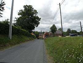
Eth is a commune in the Nord department in northern France.
It is about 10 km (6.2 mi) east-southeast of Valenciennes. Residents are called Ethois (feminine plural Ethoises).
Heraldry
.svg.png) |
The arms of Eth are blazoned : Or, a cross engrailed gules. (Artres, Bettrechies, Cerfontaine, Denain, Eth, Lesquin, Obies, Quérénaing, Semousies, Wambrechies and Warlaing use the same arms.) |
See also
References
More information about Eth
Eth ( French page ) with pictures
| Wikimedia Commons has media related to Eth (Nord). |
This article is issued from Wikipedia - version of the 11/14/2016. The text is available under the Creative Commons Attribution/Share Alike but additional terms may apply for the media files.