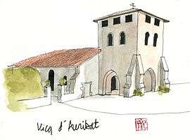
Vicq-d'Auribat
| Vicq-d'Auribat | |
|---|---|
 | |
 Vicq-d'Auribat | |
|
Location within Nouvelle-Aquitaine region  Vicq-d'Auribat | |
| Coordinates: 43°47′09″N 0°51′30″W / 43.7858°N 0.8583°WCoordinates: 43°47′09″N 0°51′30″W / 43.7858°N 0.8583°W | |
| Country | France |
| Region | Nouvelle-Aquitaine |
| Department | Landes |
| Arrondissement | Dax |
| Canton | Montfort-en-Chalosse |
| Intercommunality | Montfort-en-Chalosse |
| Government | |
| • Mayor (2014–2020) | Pacal Hontans |
| Area1 | 4.2 km2 (1.6 sq mi) |
| Population (2013)2 | 266 |
| • Density | 63/km2 (160/sq mi) |
| Time zone | CET (UTC+1) |
| • Summer (DST) | CEST (UTC+2) |
| INSEE/Postal code | 40324 / 40380 |
| Elevation |
9–45 m (30–148 ft) (avg. 13 m or 43 ft) |
|
1 French Land Register data, which excludes lakes, ponds, glaciers > 1 km² (0.386 sq mi or 247 acres) and river estuaries. 2 Population without double counting: residents of multiple communes (e.g., students and military personnel) only counted once. | |
Vicq-d'Auribat is a commune in the Landes department in Nouvelle-Aquitaine in southwestern France.
Population
| Historical population | ||
|---|---|---|
| Year | Pop. | ±% |
| 1793 | 291 | — |
| 1806 | 290 | −0.3% |
| 1821 | 303 | +4.5% |
| 1831 | 369 | +21.8% |
| 1841 | 344 | −6.8% |
| 1851 | 348 | +1.2% |
| 1861 | 349 | +0.3% |
| 1872 | 338 | −3.2% |
| 1881 | 349 | +3.3% |
| 1891 | 333 | −4.6% |
| 1901 | 319 | −4.2% |
| 1911 | 307 | −3.8% |
| 1921 | 306 | −0.3% |
| 1931 | 268 | −12.4% |
| 1946 | 257 | −4.1% |
| 1954 | 228 | −11.3% |
| 1962 | 218 | −4.4% |
| 1968 | 204 | −6.4% |
| 1975 | 189 | −7.4% |
| 1982 | 177 | −6.3% |
| 1990 | 190 | +7.3% |
| 1999 | 189 | −0.5% |
| 2008 | 259 | +37.0% |
| 2013 | 266 | +2.7% |
See also
References
| Wikimedia Commons has media related to Vicq-d'Auribat. |
This article is issued from Wikipedia - version of the 11/10/2016. The text is available under the Creative Commons Attribution/Share Alike but additional terms may apply for the media files.