Onard
| Onard | |
|---|---|
 | |
 Onard | |
|
Location within Nouvelle-Aquitaine region  Onard | |
| Coordinates: 43°46′52″N 0°50′10″W / 43.7811°N 0.8361°WCoordinates: 43°46′52″N 0°50′10″W / 43.7811°N 0.8361°W | |
| Country | France |
| Region | Nouvelle-Aquitaine |
| Department | Landes |
| Arrondissement | Dax |
| Canton | Montfort-en-Chalosse |
| Intercommunality | Montfort-en-Chalosse |
| Government | |
| • Mayor (2014–2020) | Martine Siot-Maury |
| Area1 | 6.15 km2 (2.37 sq mi) |
| Population (2013)2 | 377 |
| • Density | 61/km2 (160/sq mi) |
| Time zone | CET (UTC+1) |
| • Summer (DST) | CEST (UTC+2) |
| INSEE/Postal code | 40208 / 40380 |
| Elevation |
8–50 m (26–164 ft) (avg. 16 m or 52 ft) |
|
1 French Land Register data, which excludes lakes, ponds, glaciers > 1 km² (0.386 sq mi or 247 acres) and river estuaries. 2 Population without double counting: residents of multiple communes (e.g., students and military personnel) only counted once. | |
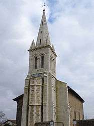
Onard is a commune in the Landes department in Nouvelle-Aquitaine in southwestern France.
Population
| Historical population | ||
|---|---|---|
| Year | Pop. | ±% |
| 1793 | 300 | — |
| 1806 | 321 | +7.0% |
| 1821 | 352 | +9.7% |
| 1831 | 431 | +22.4% |
| 1841 | 370 | −14.2% |
| 1851 | 480 | +29.7% |
| 1861 | 428 | −10.8% |
| 1872 | 407 | −4.9% |
| 1881 | 415 | +2.0% |
| 1891 | 398 | −4.1% |
| 1901 | 426 | +7.0% |
| 1911 | 405 | −4.9% |
| 1921 | 378 | −6.7% |
| 1931 | 340 | −10.1% |
| 1946 | 275 | −19.1% |
| 1954 | 288 | +4.7% |
| 1962 | 306 | +6.2% |
| 1968 | 303 | −1.0% |
| 1975 | 310 | +2.3% |
| 1982 | 315 | +1.6% |
| 1990 | 325 | +3.2% |
| 1999 | 296 | −8.9% |
| 2008 | 325 | +9.8% |
| 2013 | 377 | +16.0% |
See also
References
| Wikimedia Commons has media related to Onard. |
This article is issued from Wikipedia - version of the 11/10/2016. The text is available under the Creative Commons Attribution/Share Alike but additional terms may apply for the media files.