Habas, Landes
| Habas | ||
|---|---|---|
|
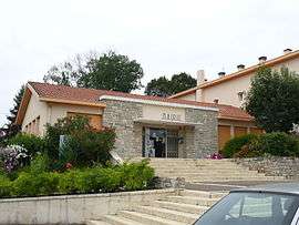
Town hall | ||
| ||
 Habas | ||
|
Location within Nouvelle-Aquitaine region  Habas | ||
| Coordinates: 43°34′21″N 0°55′42″W / 43.5725°N 0.9283°WCoordinates: 43°34′21″N 0°55′42″W / 43.5725°N 0.9283°W | ||
| Country | France | |
| Region | Nouvelle-Aquitaine | |
| Department | Landes | |
| Arrondissement | Dax | |
| Canton | Pouillon | |
| Government | ||
| • Mayor (2014–2020) | Jean-François Lataste | |
| Area1 | 18.75 km2 (7.24 sq mi) | |
| Population (2013)2 | 1,487 | |
| • Density | 79/km2 (210/sq mi) | |
| Time zone | CET (UTC+1) | |
| • Summer (DST) | CEST (UTC+2) | |
| INSEE/Postal code | 40118 / 40290 | |
| Elevation |
14–123 m (46–404 ft) (avg. 105 m or 344 ft) | |
|
1 French Land Register data, which excludes lakes, ponds, glaciers > 1 km² (0.386 sq mi or 247 acres) and river estuaries. 2 Population without double counting: residents of multiple communes (e.g., students and military personnel) only counted once. | ||

Habas is a commune in the Landes department in Nouvelle-Aquitaine in southwestern France.
Population
| Historical population | ||
|---|---|---|
| Year | Pop. | ±% |
| 1793 | 2,045 | — |
| 1806 | 1,931 | −5.6% |
| 1821 | 1,778 | −7.9% |
| 1831 | 1,938 | +9.0% |
| 1841 | 2,030 | +4.7% |
| 1851 | 2,010 | −1.0% |
| 1861 | 2,013 | +0.1% |
| 1872 | 1,915 | −4.9% |
| 1881 | 1,814 | −5.3% |
| 1891 | 1,714 | −5.5% |
| 1901 | 1,676 | −2.2% |
| 1911 | 1,680 | +0.2% |
| 1921 | 1,563 | −7.0% |
| 1931 | 1,559 | −0.3% |
| 1946 | 1,395 | −10.5% |
| 1954 | 1,389 | −0.4% |
| 1962 | 1,371 | −1.3% |
| 1968 | 1,425 | +3.9% |
| 1975 | 1,350 | −5.3% |
| 1982 | 1,290 | −4.4% |
| 1990 | 1,310 | +1.6% |
| 1999 | 1,311 | +0.1% |
| 2008 | 1,469 | +12.1% |
| 2013 | 1,487 | +1.2% |
References
See also
| Wikimedia Commons has media related to Habas. |
This article is issued from Wikipedia - version of the 11/9/2016. The text is available under the Creative Commons Attribution/Share Alike but additional terms may apply for the media files.