Eyres-Moncube
| Eyres-Moncube | |
|---|---|
 | |
 Eyres-Moncube | |
|
Location within Nouvelle-Aquitaine region  Eyres-Moncube | |
| Coordinates: 43°43′15″N 0°32′55″W / 43.7208°N 0.5486°WCoordinates: 43°43′15″N 0°32′55″W / 43.7208°N 0.5486°W | |
| Country | France |
| Region | Nouvelle-Aquitaine |
| Department | Landes |
| Arrondissement | Mont-de-Marsan |
| Canton | Saint-Sever |
| Intercommunality | Cap de Gascogne |
| Government | |
| • Mayor (2014–2020) | Yves Ducamp |
| Area1 | 12.19 km2 (4.71 sq mi) |
| Population (2013)2 | 373 |
| • Density | 31/km2 (79/sq mi) |
| Time zone | CET (UTC+1) |
| • Summer (DST) | CEST (UTC+2) |
| INSEE/Postal code | 40098 / 40500 |
| Elevation |
44–122 m (144–400 ft) (avg. 40 m or 130 ft) |
|
1 French Land Register data, which excludes lakes, ponds, glaciers > 1 km² (0.386 sq mi or 247 acres) and river estuaries. 2 Population without double counting: residents of multiple communes (e.g., students and military personnel) only counted once. | |
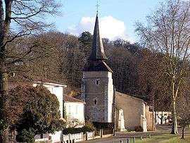
Eyres-Moncube is a commune in the Landes department in Nouvelle-Aquitaine in southwestern France.
Population
| Historical population | ||
|---|---|---|
| Year | Pop. | ±% |
| 1793 | 361 | — |
| 1806 | 407 | +12.7% |
| 1821 | 417 | +2.5% |
| 1831 | 375 | −10.1% |
| 1841 | 473 | +26.1% |
| 1851 | 746 | +57.7% |
| 1861 | 672 | −9.9% |
| 1872 | 651 | −3.1% |
| 1881 | 631 | −3.1% |
| 1891 | 579 | −8.2% |
| 1901 | 558 | −3.6% |
| 1911 | 555 | −0.5% |
| 1921 | 476 | −14.2% |
| 1931 | 480 | +0.8% |
| 1946 | 412 | −14.2% |
| 1954 | 396 | −3.9% |
| 1962 | 400 | +1.0% |
| 1968 | 386 | −3.5% |
| 1975 | 331 | −14.2% |
| 1982 | 301 | −9.1% |
| 1990 | 317 | +5.3% |
| 1999 | 342 | +7.9% |
| 2008 | 375 | +9.6% |
| 2013 | 373 | −0.5% |
See also
References
| Wikimedia Commons has media related to Eyres-Moncube. |
This article is issued from Wikipedia - version of the 11/9/2016. The text is available under the Creative Commons Attribution/Share Alike but additional terms may apply for the media files.