Sarbazan
| Sarbazan | ||
|---|---|---|
 | ||
| ||
 Sarbazan | ||
|
Location within Nouvelle-Aquitaine region  Sarbazan | ||
| Coordinates: 44°01′11″N 0°18′37″W / 44.0197°N 0.3103°WCoordinates: 44°01′11″N 0°18′37″W / 44.0197°N 0.3103°W | ||
| Country | France | |
| Region | Nouvelle-Aquitaine | |
| Department | Landes | |
| Arrondissement | Mont-de-Marsan | |
| Canton | Roquefort | |
| Intercommunality | Pays de Roquefort | |
| Government | ||
| • Mayor (2014–2020) | Philippe Lamarque | |
| Area1 | 22.44 km2 (8.66 sq mi) | |
| Population (2013)2 | 1,155 | |
| • Density | 51/km2 (130/sq mi) | |
| Time zone | CET (UTC+1) | |
| • Summer (DST) | CEST (UTC+2) | |
| INSEE/Postal code | 40288 / 40120 | |
| Elevation |
54–112 m (177–367 ft) (avg. 100 m or 330 ft) | |
|
1 French Land Register data, which excludes lakes, ponds, glaciers > 1 km² (0.386 sq mi or 247 acres) and river estuaries. 2 Population without double counting: residents of multiple communes (e.g., students and military personnel) only counted once. | ||
.svg.png)
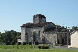
Sarbazan is a commune in the Landes department in Nouvelle-Aquitaine in southwestern France.
Population
| Historical population | ||
|---|---|---|
| Year | Pop. | ±% |
| 1793 | 648 | — |
| 1806 | 322 | −50.3% |
| 1821 | 504 | +56.5% |
| 1831 | 691 | +37.1% |
| 1841 | 737 | +6.7% |
| 1851 | 760 | +3.1% |
| 1861 | 779 | +2.5% |
| 1872 | 781 | +0.3% |
| 1881 | 713 | −8.7% |
| 1891 | 733 | +2.8% |
| 1901 | 706 | −3.7% |
| 1911 | 655 | −7.2% |
| 1921 | 628 | −4.1% |
| 1931 | 589 | −6.2% |
| 1946 | 612 | +3.9% |
| 1954 | 623 | +1.8% |
| 1962 | 726 | +16.5% |
| 1968 | 730 | +0.6% |
| 1975 | 806 | +10.4% |
| 1982 | 872 | +8.2% |
| 1990 | 940 | +7.8% |
| 1999 | 941 | +0.1% |
| 2008 | 1,083 | +15.1% |
| 2013 | 1,155 | +6.6% |
See also
References
| Wikimedia Commons has media related to Sarbazan. |
This article is issued from Wikipedia - version of the 11/10/2016. The text is available under the Creative Commons Attribution/Share Alike but additional terms may apply for the media files.