Escource
| Escource | |
|---|---|
|
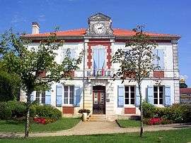
Town hall | |
 Escource | |
|
Location within Nouvelle-Aquitaine region  Escource | |
| Coordinates: 44°09′55″N 1°01′55″W / 44.1653°N 1.0319°WCoordinates: 44°09′55″N 1°01′55″W / 44.1653°N 1.0319°W | |
| Country | France |
| Region | Nouvelle-Aquitaine |
| Department | Landes |
| Arrondissement | Mont-de-Marsan |
| Canton | Sabres |
| Intercommunality | Haute Lande |
| Government | |
| • Mayor (2014–2020) | Patrick Sabin |
| Area1 | 102.74 km2 (39.67 sq mi) |
| Population (2013)2 | 659 |
| • Density | 6.4/km2 (17/sq mi) |
| Time zone | CET (UTC+1) |
| • Summer (DST) | CEST (UTC+2) |
| INSEE/Postal code | 40094 / 40210 |
| Elevation |
23–84 m (75–276 ft) (avg. 75 m or 246 ft) |
|
1 French Land Register data, which excludes lakes, ponds, glaciers > 1 km² (0.386 sq mi or 247 acres) and river estuaries. 2 Population without double counting: residents of multiple communes (e.g., students and military personnel) only counted once. | |
Escource is a commune in the Landes department in Nouvelle-Aquitaine in southwestern France.
Population
| Historical population | ||
|---|---|---|
| Year | Pop. | ±% |
| 1793 | 900 | — |
| 1806 | 673 | −25.2% |
| 1821 | 881 | +30.9% |
| 1831 | 1,061 | +20.4% |
| 1841 | 1,180 | +11.2% |
| 1851 | 1,304 | +10.5% |
| 1861 | 1,617 | +24.0% |
| 1872 | 1,298 | −19.7% |
| 1881 | 1,219 | −6.1% |
| 1891 | 1,270 | +4.2% |
| 1901 | 1,200 | −5.5% |
| 1911 | 1,125 | −6.2% |
| 1921 | 1,041 | −7.5% |
| 1931 | 951 | −8.6% |
| 1946 | 704 | −26.0% |
| 1954 | 729 | +3.6% |
| 1962 | 686 | −5.9% |
| 1968 | 585 | −14.7% |
| 1975 | 522 | −10.8% |
| 1982 | 523 | +0.2% |
| 1990 | 612 | +17.0% |
| 1999 | 606 | −1.0% |
| 2008 | 596 | −1.7% |
| 2013 | 659 | +10.6% |
See also
References
| Wikimedia Commons has media related to Escource. |
This article is issued from Wikipedia - version of the 11/9/2016. The text is available under the Creative Commons Attribution/Share Alike but additional terms may apply for the media files.