Puyol-Cazalet
| Puyol-Cazalet | |
|---|---|
 | |
 Puyol-Cazalet | |
|
Location within Nouvelle-Aquitaine region  Puyol-Cazalet | |
| Coordinates: 43°36′18″N 0°24′21″W / 43.605°N 0.4058°WCoordinates: 43°36′18″N 0°24′21″W / 43.605°N 0.4058°W | |
| Country | France |
| Region | Nouvelle-Aquitaine |
| Department | Landes |
| Arrondissement | Mont-de-Marsan |
| Canton | Geaune |
| Intercommunality | Tursan |
| Government | |
| • Mayor (20014–2020) | Jacques Labenne |
| Area1 | 4.59 km2 (1.77 sq mi) |
| Population (2013)2 | 114 |
| • Density | 25/km2 (64/sq mi) |
| Time zone | CET (UTC+1) |
| • Summer (DST) | CEST (UTC+2) |
| INSEE/Postal code | 40239 / 40320 |
| Elevation |
90–167 m (295–548 ft) (avg. 170 m or 560 ft) |
|
1 French Land Register data, which excludes lakes, ponds, glaciers > 1 km² (0.386 sq mi or 247 acres) and river estuaries. 2 Population without double counting: residents of multiple communes (e.g., students and military personnel) only counted once. | |
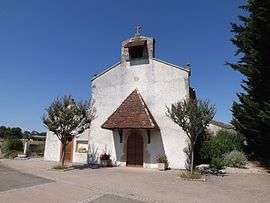
Puyol-Cazalet is a commune in the Landes department in Nouvelle-Aquitaine in southwestern France.
Population
| Historical population | ||
|---|---|---|
| Year | Pop. | ±% |
| 1793 | 183 | — |
| 1806 | 151 | −17.5% |
| 1821 | 182 | +20.5% |
| 1831 | 206 | +13.2% |
| 1841 | 209 | +1.5% |
| 1851 | 253 | +21.1% |
| 1861 | 248 | −2.0% |
| 1872 | 233 | −6.0% |
| 1881 | 224 | −3.9% |
| 1891 | 203 | −9.4% |
| 1901 | 194 | −4.4% |
| 1911 | 179 | −7.7% |
| 1921 | 178 | −0.6% |
| 1931 | 163 | −8.4% |
| 1946 | 145 | −11.0% |
| 1954 | 147 | +1.4% |
| 1962 | 131 | −10.9% |
| 1968 | 113 | −13.7% |
| 1975 | 105 | −7.1% |
| 1982 | 106 | +1.0% |
| 1990 | 105 | −0.9% |
| 1999 | 96 | −8.6% |
| 2008 | 108 | +12.5% |
| 2013 | 114 | +5.6% |
See also
References
| Wikimedia Commons has media related to Puyol-Cazalet. |
This article is issued from Wikipedia - version of the 11/10/2016. The text is available under the Creative Commons Attribution/Share Alike but additional terms may apply for the media files.