Léguevin
| Léguevin | ||
|---|---|---|
|
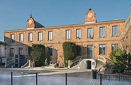
Town hall | ||
| ||
 Léguevin | ||
|
Location within Occitanie region  Léguevin | ||
| Coordinates: 43°35′59″N 1°14′02″E / 43.5997°N 1.2339°ECoordinates: 43°35′59″N 1°14′02″E / 43.5997°N 1.2339°E | ||
| Country | France | |
| Region | Occitanie | |
| Department | Haute-Garonne | |
| Arrondissement | Toulouse | |
| Canton | Léguevin | |
| Intercommunality | Save le Touch | |
| Government | ||
| • Mayor (2008–2014) | Stéphane Mirc | |
| Area1 | 24.45 km2 (9.44 sq mi) | |
| Population (2008)2 | 7,853 | |
| • Density | 320/km2 (830/sq mi) | |
| Time zone | CET (UTC+1) | |
| • Summer (DST) | CEST (UTC+2) | |
| INSEE/Postal code | 31291 / 31490 | |
| Elevation | 164–237 m (538–778 ft) | |
|
1 French Land Register data, which excludes lakes, ponds, glaciers > 1 km² (0.386 sq mi or 247 acres) and river estuaries. 2 Population without double counting: residents of multiple communes (e.g., students and military personnel) only counted once. | ||
.svg.png)
Léguevin is a commune in the Haute-Garonne department in southwestern France.
Population
| Historical population | ||
|---|---|---|
| Year | Pop. | ±% |
| 1962 | 1,014 | — |
| 1968 | 1,622 | +60.0% |
| 1975 | 2,091 | +28.9% |
| 1982 | 2,764 | +32.2% |
| 1990 | 4,217 | +52.6% |
| 1999 | 6,172 | +46.4% |
| 2008 | 7,853 | +27.2% |
Monuments
 The Church.
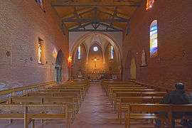 The Nave.
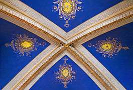 The church ceiling.
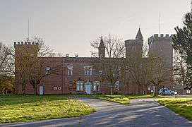 The castle.
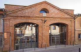 Covert market.
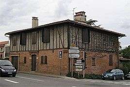 The former Post.
See also
References
| Wikimedia Commons has media related to Léguevin. |
This article is issued from Wikipedia - version of the 2/21/2015. The text is available under the Creative Commons Attribution/Share Alike but additional terms may apply for the media files.