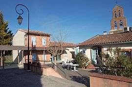
Clermont-le-Fort
| Clermont-le-Fort | ||
|---|---|---|
|
Town hall | ||
| ||
 Clermont-le-Fort | ||
|
Location within Occitanie region  Clermont-le-Fort | ||
| Coordinates: 43°27′32″N 1°26′00″E / 43.4589°N 1.4333°ECoordinates: 43°27′32″N 1°26′00″E / 43.4589°N 1.4333°E | ||
| Country | France | |
| Region | Occitanie | |
| Department | Haute-Garonne | |
| Arrondissement | Toulouse | |
| Canton | Castanet-Tolosan | |
| Intercommunality | Sicoval | |
| Government | ||
| • Mayor (2008–2014) | Daniel Zanchetta | |
| Area1 | 10.04 km2 (3.88 sq mi) | |
| Population (2008)2 | 517 | |
| • Density | 51/km2 (130/sq mi) | |
| Time zone | CET (UTC+1) | |
| • Summer (DST) | CEST (UTC+2) | |
| INSEE/Postal code | 31148 / 31810 | |
| Elevation |
152–282 m (499–925 ft) (avg. 240 m or 790 ft) | |
|
1 French Land Register data, which excludes lakes, ponds, glaciers > 1 km² (0.386 sq mi or 247 acres) and river estuaries. 2 Population without double counting: residents of multiple communes (e.g., students and military personnel) only counted once. | ||
.svg.png)
Clermont-le-Fort is a commune in the Haute-Garonne department in southwestern France.
Geography
The Ariège forms most of the commune's western border, with the Lèze, one of its tributaries, which flows here into the Ariège.
Population
| Historical population | ||
|---|---|---|
| Year | Pop. | ±% |
| 1962 | 241 | — |
| 1968 | 242 | +0.4% |
| 1975 | 250 | +3.3% |
| 1982 | 308 | +23.2% |
| 1990 | 359 | +16.6% |
| 1999 | 464 | +29.2% |
| 2008 | 517 | +11.4% |
 Church St Peter.
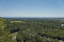 Panorama
See also
References
| Wikimedia Commons has media related to Clermont-le-Fort. |
This article is issued from Wikipedia - version of the 8/22/2014. The text is available under the Creative Commons Attribution/Share Alike but additional terms may apply for the media files.