Ganties
| Ganties | |
|---|---|
 | |
 Ganties | |
|
Location within Occitanie region  Ganties | |
| Coordinates: 43°03′56″N 0°49′55″E / 43.0656°N 0.8319°ECoordinates: 43°03′56″N 0°49′55″E / 43.0656°N 0.8319°E | |
| Country | France |
| Region | Occitanie |
| Department | Haute-Garonne |
| Arrondissement | Saint-Gaudens |
| Canton | Aspet |
| Intercommunality | Trois Vallées |
| Government | |
| • Mayor (2008–2014) | Henri Dispagne |
| Area1 | 12.03 km2 (4.64 sq mi) |
| Population (2008)2 | 296 |
| • Density | 25/km2 (64/sq mi) |
| Time zone | CET (UTC+1) |
| • Summer (DST) | CEST (UTC+2) |
| INSEE/Postal code | 31208 / 31160 |
| Elevation |
355–501 m (1,165–1,644 ft) (avg. 420 m or 1,380 ft) |
|
1 French Land Register data, which excludes lakes, ponds, glaciers > 1 km² (0.386 sq mi or 247 acres) and river estuaries. 2 Population without double counting: residents of multiple communes (e.g., students and military personnel) only counted once. | |
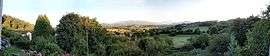
Ganties is a commune in the Haute-Garonne department in southwestern France.
Population
| Historical population | ||
|---|---|---|
| Year | Pop. | ±% |
| 1962 | 233 | — |
| 1968 | 271 | +16.3% |
| 1975 | 252 | −7.0% |
| 1982 | 255 | +1.2% |
| 1990 | 247 | −3.1% |
| 1999 | 244 | −1.2% |
| 2008 | 296 | +21.3% |
See also
References
| Wikimedia Commons has media related to Ganties. |
This article is issued from Wikipedia - version of the 3/21/2014. The text is available under the Creative Commons Attribution/Share Alike but additional terms may apply for the media files.