Cazères
| Cazères | ||
|---|---|---|
|
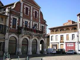
Town hall | ||
| ||
 Cazères | ||
|
Location within Occitanie region  Cazères | ||
| Coordinates: 43°12′26″N 1°05′12″E / 43.2072°N 1.0867°ECoordinates: 43°12′26″N 1°05′12″E / 43.2072°N 1.0867°E | ||
| Country | France | |
| Region | Occitanie | |
| Department | Haute-Garonne | |
| Arrondissement | Muret | |
| Canton | Cazères | |
| Government | ||
| • Mayor (2008–2014) | Michel Oliva | |
| Area1 | 19.55 km2 (7.55 sq mi) | |
| Population (2008)2 | 4,302 | |
| • Density | 220/km2 (570/sq mi) | |
| Time zone | CET (UTC+1) | |
| • Summer (DST) | CEST (UTC+2) | |
| INSEE/Postal code | 31135 / 31220 | |
| Elevation |
215–362 m (705–1,188 ft) (avg. 240 m or 790 ft) | |
|
1 French Land Register data, which excludes lakes, ponds, glaciers > 1 km² (0.386 sq mi or 247 acres) and river estuaries. 2 Population without double counting: residents of multiple communes (e.g., students and military personnel) only counted once. | ||
.svg.png)
Cazères is a commune in the Haute-Garonne department in southwestern France.
Population
| Historical population | ||
|---|---|---|
| Year | Pop. | ±% |
| 1962 | 3,050 | — |
| 1968 | 3,405 | +11.6% |
| 1975 | 3,419 | +0.4% |
| 1982 | 3,294 | −3.7% |
| 1990 | 3,155 | −4.2% |
| 1999 | 3,260 | +3.3% |
| 2008 | 4,302 | +32.0% |
| 2009 | 4 485 | — |
| 2010 | — | |
| 2011 | — | |
| 2012 | — | |
| 2013 | — | |
| 2014 | — | |
See also
References
External links
| Wikimedia Commons has media related to Cazères. |
This article is issued from Wikipedia - version of the 11/17/2014. The text is available under the Creative Commons Attribution/Share Alike but additional terms may apply for the media files.