Baziège
| Baziège | ||
|---|---|---|
 | ||
| ||
 Baziège | ||
|
Location within Occitanie region  Baziège | ||
| Coordinates: 43°27′19″N 1°36′58″E / 43.4554°N 1.616°ECoordinates: 43°27′19″N 1°36′58″E / 43.4554°N 1.616°E | ||
| Country | France | |
| Region | Occitanie | |
| Department | Haute-Garonne | |
| Arrondissement | Toulouse | |
| Canton | Montgiscard | |
| Intercommunality | Sicoval | |
| Government | ||
| • Mayor (2008–2014) | Robert Gendre | |
| Area1 | 19.72 km2 (7.61 sq mi) | |
| Population (2008)2 | 3,212 | |
| • Density | 160/km2 (420/sq mi) | |
| Time zone | CET (UTC+1) | |
| • Summer (DST) | CEST (UTC+2) | |
| INSEE/Postal code | 31048 / 31450 | |
| Elevation |
156–253 m (512–830 ft) (avg. 180 m or 590 ft) | |
|
1 French Land Register data, which excludes lakes, ponds, glaciers > 1 km² (0.386 sq mi or 247 acres) and river estuaries. 2 Population without double counting: residents of multiple communes (e.g., students and military personnel) only counted once. | ||
.svg.png)
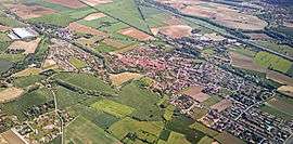
Baziège is a commune in the Haute-Garonne department in southwestern France.
Population
| Historical population | ||
|---|---|---|
| Year | Pop. | ±% |
| 1962 | 1,146 | — |
| 1968 | 1,194 | +4.2% |
| 1975 | 1,280 | +7.2% |
| 1982 | 1,648 | +28.8% |
| 1990 | 1,874 | +13.7% |
| 1999 | 2,196 | +17.2% |
| 2008 | 3,212 | +46.3% |
Monument
_%C3%A9glise_de_style_toulousain_(1).JPG)
See also
References
External links
| Wikimedia Commons has media related to Baziège. |
This article is issued from Wikipedia - version of the 9/16/2015. The text is available under the Creative Commons Attribution/Share Alike but additional terms may apply for the media files.