Brouzet-lès-Alès
| Brouzet-lès-Alès | ||
|---|---|---|
|
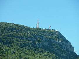
Mont Bouquet | ||
| ||
 Brouzet-lès-Alès | ||
|
Location within Occitanie region  Brouzet-lès-Alès | ||
| Coordinates: 44°08′18″N 4°14′49″E / 44.1383°N 4.2469°ECoordinates: 44°08′18″N 4°14′49″E / 44.1383°N 4.2469°E | ||
| Country | France | |
| Region | Occitanie | |
| Department | Gard | |
| Arrondissement | Alès | |
| Canton | Vézénobres | |
| Intercommunality | Mont Bouquet | |
| Government | ||
| • Mayor (2008–2014) | Jacques Boudet | |
| Area1 | 13.03 km2 (5.03 sq mi) | |
| Population (2008)2 | 586 | |
| • Density | 45/km2 (120/sq mi) | |
| Time zone | CET (UTC+1) | |
| • Summer (DST) | CEST (UTC+2) | |
| INSEE/Postal code | 30055 / 30580 | |
| Elevation |
159–623 m (522–2,044 ft) (avg. 235 m or 771 ft) | |
|
1 French Land Register data, which excludes lakes, ponds, glaciers > 1 km² (0.386 sq mi or 247 acres) and river estuaries. 2 Population without double counting: residents of multiple communes (e.g., students and military personnel) only counted once. | ||
.svg.png)
Brouzet-lès-Alès is a commune in the Gard department in southern France.
Population
| Historical population | ||
|---|---|---|
| Year | Pop. | ±% |
| 1793 | 379 | — |
| 1821 | 307 | −19.0% |
| 1846 | 515 | +67.8% |
| 1872 | 473 | −8.2% |
| 1901 | 477 | +0.8% |
| 1926 | 390 | −18.2% |
| 1946 | 395 | +1.3% |
| 1962 | 319 | −19.2% |
| 1968 | 342 | +7.2% |
| 1975 | 343 | +0.3% |
| 1982 | 348 | +1.5% |
| 1990 | 392 | +12.6% |
| 1999 | 436 | +11.2% |
| 2008 | 586 | +34.4% |
See also
References
| Wikimedia Commons has media related to Brouzet-lès-Alès. |
This article is issued from Wikipedia - version of the 9/17/2015. The text is available under the Creative Commons Attribution/Share Alike but additional terms may apply for the media files.