Cornillon
For the commune in Haiti, see Cornillon, Ouest.
| Cornillon | ||
|---|---|---|
|
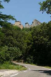
Ruins at Cornillon | ||
| ||
 Cornillon | ||
|
Location within Occitanie region  Cornillon | ||
| Coordinates: 44°13′33″N 4°29′15″E / 44.2258°N 4.4875°ECoordinates: 44°13′33″N 4°29′15″E / 44.2258°N 4.4875°E | ||
| Country | France | |
| Region | Occitanie | |
| Department | Gard | |
| Arrondissement | Nîmes | |
| Canton | Pont-Saint-Esprit | |
| Intercommunality | ValCezArd | |
| Government | ||
| • Mayor (2008–2014) | Gérard Castor | |
| Area1 | 15.58 km2 (6.02 sq mi) | |
| Population (2008)2 | 869 | |
| • Density | 56/km2 (140/sq mi) | |
| Time zone | CET (UTC+1) | |
| • Summer (DST) | CEST (UTC+2) | |
| INSEE/Postal code | 30096 / 30630 | |
| Elevation |
58–360 m (190–1,181 ft) (avg. 180 m or 590 ft) | |
|
1 French Land Register data, which excludes lakes, ponds, glaciers > 1 km² (0.386 sq mi or 247 acres) and river estuaries. 2 Population without double counting: residents of multiple communes (e.g., students and military personnel) only counted once. | ||

Cornillon is a commune in the Gard department in southern France.
Population
| Historical population | ||
|---|---|---|
| Year | Pop. | ±% |
| 1962 | 422 | — |
| 1968 | 432 | +2.4% |
| 1975 | 448 | +3.7% |
| 1982 | 538 | +20.1% |
| 1990 | 609 | +13.2% |
| 1999 | 689 | +13.1% |
| 2008 | 869 | +26.1% |
See also
References
| Wikimedia Commons has media related to Cornillon. |
This article is issued from Wikipedia - version of the 11/7/2016. The text is available under the Creative Commons Attribution/Share Alike but additional terms may apply for the media files.