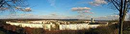
Behren-lès-Forbach
| Behren-lès-Forbach | ||
|---|---|---|
 | ||
| ||
 Behren-lès-Forbach | ||
|
Location within Grand Est region  Behren-lès-Forbach | ||
| Coordinates: 49°10′28″N 6°56′08″E / 49.1744°N 6.9356°ECoordinates: 49°10′28″N 6°56′08″E / 49.1744°N 6.9356°E | ||
| Country | France | |
| Region | Grand Est | |
| Department | Moselle | |
| Arrondissement | Forbach-Boulay-Moselle | |
| Canton | Stiring-Wendel | |
| Intercommunality | Forbach Porte de France | |
| Government | ||
| • Mayor (2008–2014) | Jérôme Dibo | |
| Area1 | 5.54 km2 (2.14 sq mi) | |
| Population (2009)2 | 8,535 | |
| • Density | 1,500/km2 (4,000/sq mi) | |
| Time zone | CET (UTC+1) | |
| • Summer (DST) | CEST (UTC+2) | |
| INSEE/Postal code | 57058 / 57460 | |
| Elevation | 243–382 m (797–1,253 ft) | |
|
1 French Land Register data, which excludes lakes, ponds, glaciers > 1 km² (0.386 sq mi or 247 acres) and river estuaries. 2 Population without double counting: residents of multiple communes (e.g., students and military personnel) only counted once. | ||
.svg.png)
Behren-lès-Forbach is a commune in the Moselle department in Grand Est in northeastern France.
Population
| Historical population | ||
|---|---|---|
| Year | Pop. | ±% |
| 1793 | 250 | — |
| 1800 | 244 | −2.4% |
| 1806 | 291 | +19.3% |
| 1926 | 519 | +78.4% |
| 1931 | 502 | −3.3% |
| 1936 | 473 | −5.8% |
| 1946 | 429 | −9.3% |
| 1954 | 534 | +24.5% |
| 1962 | 10,486 | +1863.7% |
| 1968 | 12,512 | +19.3% |
| 1975 | 12,015 | −4.0% |
| 1982 | 11,152 | −7.2% |
| 1990 | 10,291 | −7.7% |
| 1999 | 10,073 | −2.1% |
| 2006 | 9,146 | −9.2% |
| 2009 | 8,535 | −6.7% |
See also
References
External links
| Wikimedia Commons has media related to Behren-lès-Forbach. |
This article is issued from Wikipedia - version of the 11/17/2016. The text is available under the Creative Commons Attribution/Share Alike but additional terms may apply for the media files.