Budling
| Budling | ||
|---|---|---|
 | ||
| ||
 Budling | ||
|
Location within Grand Est region  Budling | ||
| Coordinates: 49°20′51″N 6°21′23″E / 49.3475°N 6.3564°ECoordinates: 49°20′51″N 6°21′23″E / 49.3475°N 6.3564°E | ||
| Country | France | |
| Region | Grand Est | |
| Department | Moselle | |
| Arrondissement | Thionville | |
| Canton | Metzervisse | |
| Intercommunality | Arc mosellan | |
| Government | ||
| • Mayor (2008–2014) | Jean-Gérard Guirkinger | |
| Area1 | 5.73 km2 (2.21 sq mi) | |
| Population (2009)2 | 168 | |
| • Density | 29/km2 (76/sq mi) | |
| Time zone | CET (UTC+1) | |
| • Summer (DST) | CEST (UTC+2) | |
| INSEE/Postal code | 57118 / 57970 | |
| Elevation |
176–343 m (577–1,125 ft) (avg. 233 m or 764 ft) | |
|
1 French Land Register data, which excludes lakes, ponds, glaciers > 1 km² (0.386 sq mi or 247 acres) and river estuaries. 2 Population without double counting: residents of multiple communes (e.g., students and military personnel) only counted once. | ||
.svg.png)
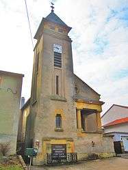
Budling (Lorraine Franconian: Bidléngen) is a commune in the Moselle department in Grand Est in northeastern France.
Population
| Historical population | ||
|---|---|---|
| Year | Pop. | ±% |
| 1962 | 149 | — |
| 1968 | 162 | +8.7% |
| 1975 | 162 | +0.0% |
| 1982 | 173 | +6.8% |
| 1990 | 158 | −8.7% |
| 1999 | 157 | −0.6% |
| 2006 | 169 | +7.6% |
| 2009 | 168 | −0.6% |
See also
References
This article is issued from Wikipedia - version of the 11/17/2016. The text is available under the Creative Commons Attribution/Share Alike but additional terms may apply for the media files.