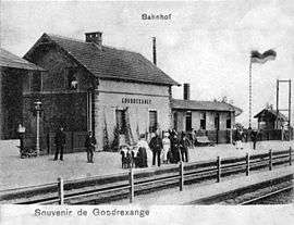
Gondrexange
| Gondrexange | ||
|---|---|---|
 | ||
| ||
 Gondrexange | ||
|
Location within Grand Est region  Gondrexange | ||
| Coordinates: 48°41′06″N 6°55′42″E / 48.685°N 6.9283°ECoordinates: 48°41′06″N 6°55′42″E / 48.685°N 6.9283°E | ||
| Country | France | |
| Region | Grand Est | |
| Department | Moselle | |
| Arrondissement | Sarrebourg-Château-Salins | |
| Canton | Sarrebourg | |
| Intercommunality | Communauté de communes du Pays des Étangs | |
| Government | ||
| • Mayor (2008–2014) | André Demange | |
| Area1 | 22.88 km2 (8.83 sq mi) | |
| Population (1999)2 | 459 | |
| • Density | 20/km2 (52/sq mi) | |
| Time zone | CET (UTC+1) | |
| • Summer (DST) | CEST (UTC+2) | |
| INSEE/Postal code | 57253 / 57815 | |
| Elevation |
266–319 m (873–1,047 ft) (avg. 270 m or 890 ft) | |
|
1 French Land Register data, which excludes lakes, ponds, glaciers > 1 km² (0.386 sq mi or 247 acres) and river estuaries. 2 Population without double counting: residents of multiple communes (e.g., students and military personnel) only counted once. | ||
.svg.png)
Gondrexange (German: Gunderchingen) is a commune in the Moselle department in Grand Est in north-eastern France.
See also
This article is issued from Wikipedia - version of the 11/17/2016. The text is available under the Creative Commons Attribution/Share Alike but additional terms may apply for the media files.