Tréminis
| Tréminis | |
|---|---|
 | |
 Tréminis | |
|
Location within Auvergne-Rhône-Alpes region  Tréminis | |
| Coordinates: 44°44′54″N 5°46′11″E / 44.7483°N 5.7697°ECoordinates: 44°44′54″N 5°46′11″E / 44.7483°N 5.7697°E | |
| Country | France |
| Region | Auvergne-Rhône-Alpes |
| Department | Isère |
| Arrondissement | Grenoble |
| Canton | Mens |
| Intercommunality | Mens |
| Government | |
| • Mayor (2014–2020) | Frédéric Aubert |
| Area1 | 49 km2 (19 sq mi) |
| Population (2012)2 | 178 |
| • Density | 3.6/km2 (9.4/sq mi) |
| Time zone | CET (UTC+1) |
| • Summer (DST) | CEST (UTC+2) |
| INSEE/Postal code | 38514 / 38710 |
| Elevation |
792–2,755 m (2,598–9,039 ft) (avg. 933 m or 3,061 ft) |
|
1 French Land Register data, which excludes lakes, ponds, glaciers > 1 km² (0.386 sq mi or 247 acres) and river estuaries. 2 Population without double counting: residents of multiple communes (e.g., students and military personnel) only counted once. | |
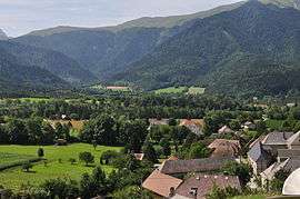
Tréminis is a commune in the Isère department in southeastern France.
Population
| Historical population | ||
|---|---|---|
| Year | Pop. | ±% |
| 1793 | 536 | — |
| 1806 | 582 | +8.6% |
| 1821 | 563 | −3.3% |
| 1831 | 626 | +11.2% |
| 1841 | 596 | −4.8% |
| 1851 | 608 | +2.0% |
| 1861 | 562 | −7.6% |
| 1872 | 568 | +1.1% |
| 1881 | 507 | −10.7% |
| 1891 | 507 | +0.0% |
| 1901 | 431 | −15.0% |
| 1911 | 401 | −7.0% |
| 1921 | 311 | −22.4% |
| 1931 | 328 | +5.5% |
| 1946 | 315 | −4.0% |
| 1954 | 332 | +5.4% |
| 1962 | 294 | −11.4% |
| 1968 | 260 | −11.6% |
| 1975 | 207 | −20.4% |
| 1982 | 191 | −7.7% |
| 1990 | 173 | −9.4% |
| 1999 | 172 | −0.6% |
| 2006 | 164 | −4.7% |
| 2012 | 178 | +8.5% |
See also
References
| Wikimedia Commons has media related to Tréminis. |
This article is issued from Wikipedia - version of the 3/15/2016. The text is available under the Creative Commons Attribution/Share Alike but additional terms may apply for the media files.