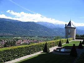
Le Touvet
| Le Touvet | ||
|---|---|---|
 | ||
| ||
 Le Touvet | ||
|
Location within Auvergne-Rhône-Alpes region  Le Touvet | ||
| Coordinates: 45°21′30″N 5°56′55″E / 45.3583°N 5.9486°ECoordinates: 45°21′30″N 5°56′55″E / 45.3583°N 5.9486°E | ||
| Country | France | |
| Region | Auvergne-Rhône-Alpes | |
| Department | Isère | |
| Arrondissement | Grenoble | |
| Canton | Le Touvet | |
| Intercommunality | Pays du Grésivaudan | |
| Government | ||
| • Mayor (2014–2020) | Laurence Théry | |
| Area1 | 11.6 km2 (4.5 sq mi) | |
| Population (2012)2 | 3,003 | |
| • Density | 260/km2 (670/sq mi) | |
| Time zone | CET (UTC+1) | |
| • Summer (DST) | CEST (UTC+2) | |
| INSEE/Postal code | 38511 / 38660 | |
| Elevation | 236–1,008 m (774–3,307 ft) | |
|
1 French Land Register data, which excludes lakes, ponds, glaciers > 1 km² (0.386 sq mi or 247 acres) and river estuaries. 2 Population without double counting: residents of multiple communes (e.g., students and military personnel) only counted once. | ||

Le Touvet is a commune in the Isère department in southeastern France.
Population
| Historical population | ||
|---|---|---|
| Year | Pop. | ±% |
| 1793 | 1,082 | — |
| 1806 | 1,367 | +26.3% |
| 1821 | 1,438 | +5.2% |
| 1831 | 1,796 | +24.9% |
| 1841 | 1,683 | −6.3% |
| 1851 | 1,646 | −2.2% |
| 1861 | 1,625 | −1.3% |
| 1872 | 1,595 | −1.8% |
| 1881 | 1,550 | −2.8% |
| 1891 | 1,363 | −12.1% |
| 1901 | 1,299 | −4.7% |
| 1911 | 1,154 | −11.2% |
| 1921 | 1,034 | −10.4% |
| 1931 | 986 | −4.6% |
| 1946 | 954 | −3.2% |
| 1954 | 1,012 | +6.1% |
| 1962 | 1,115 | +10.2% |
| 1968 | 1,278 | +14.6% |
| 1975 | 1,562 | +22.2% |
| 1982 | 1,857 | +18.9% |
| 1990 | 2,229 | +20.0% |
| 1999 | 2,824 | +26.7% |
| 2006 | 2,979 | +5.5% |
| 2012 | 3,003 | +0.8% |
See also
References
| Wikimedia Commons has media related to Le Touvet. |
This article is issued from Wikipedia - version of the 3/15/2016. The text is available under the Creative Commons Attribution/Share Alike but additional terms may apply for the media files.