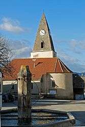
Prébois
| Prébois | |
|---|---|
 | |
 Prébois | |
|
Location within Auvergne-Rhône-Alpes region  Prébois | |
| Coordinates: 44°47′24″N 5°41′45″E / 44.79°N 5.6958°ECoordinates: 44°47′24″N 5°41′45″E / 44.79°N 5.6958°E | |
| Country | France |
| Region | Auvergne-Rhône-Alpes |
| Department | Isère |
| Arrondissement | Grenoble |
| Canton | Mens |
| Intercommunality | Mens |
| Government | |
| • Mayor (2014–2020) | Jean-François Helly |
| Area1 | 16 km2 (6 sq mi) |
| Population (2011)2 | 166 |
| • Density | 10/km2 (27/sq mi) |
| Time zone | CET (UTC+1) |
| • Summer (DST) | CEST (UTC+2) |
| INSEE/Postal code | 38321 / 38710 |
| Elevation | 596–1,720 m (1,955–5,643 ft) |
|
1 French Land Register data, which excludes lakes, ponds, glaciers > 1 km² (0.386 sq mi or 247 acres) and river estuaries. 2 Population without double counting: residents of multiple communes (e.g., students and military personnel) only counted once. | |
Prébois is a commune in the Isère department in southeastern France.
Population
| Historical population | ||
|---|---|---|
| Year | Pop. | ±% |
| 1793 | 331 | — |
| 1806 | 372 | +12.4% |
| 1821 | 345 | −7.3% |
| 1831 | 349 | +1.2% |
| 1841 | 320 | −8.3% |
| 1851 | 323 | +0.9% |
| 1861 | 318 | −1.5% |
| 1872 | 318 | +0.0% |
| 1881 | 300 | −5.7% |
| 1891 | 300 | +0.0% |
| 1901 | 290 | −3.3% |
| 1911 | 302 | +4.1% |
| 1921 | 280 | −7.3% |
| 1931 | 216 | −22.9% |
| 1946 | 204 | −5.6% |
| 1954 | 161 | −21.1% |
| 1962 | 159 | −1.2% |
| 1968 | 141 | −11.3% |
| 1975 | 135 | −4.3% |
| 1982 | 142 | +5.2% |
| 1990 | 137 | −3.5% |
| 1999 | 139 | +1.5% |
| 2006 | 156 | +12.2% |
| 2011 | 166 | +6.4% |
See also
References
| Wikimedia Commons has media related to Prébois. |
This article is issued from Wikipedia - version of the 10/28/2016. The text is available under the Creative Commons Attribution/Share Alike but additional terms may apply for the media files.