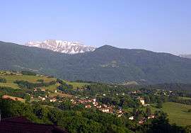
Herbeys
| Herbeys | ||
|---|---|---|
 | ||
| ||
 Herbeys | ||
|
Location within Auvergne-Rhône-Alpes region  Herbeys | ||
| Coordinates: 45°08′20″N 5°47′36″E / 45.1390°N 5.7934°ECoordinates: 45°08′20″N 5°47′36″E / 45.1390°N 5.7934°E | ||
| Country | France | |
| Region | Auvergne-Rhône-Alpes | |
| Department | Isère | |
| Arrondissement | Grenoble | |
| Canton | Eybens | |
| Intercommunality | Sud Grenoblois | |
| Government | ||
| • Mayor (2014–2020) | Françoise Reverbel | |
| Area1 | 7.73 km2 (2.98 sq mi) | |
| Population (2011)2 | 1,349 | |
| • Density | 170/km2 (450/sq mi) | |
| Time zone | CET (UTC+1) | |
| • Summer (DST) | CEST (UTC+2) | |
| INSEE/Postal code | 38188 / 38320 | |
| Elevation | 417–935 m (1,368–3,068 ft) | |
|
1 French Land Register data, which excludes lakes, ponds, glaciers > 1 km² (0.386 sq mi or 247 acres) and river estuaries. 2 Population without double counting: residents of multiple communes (e.g., students and military personnel) only counted once. | ||

Herbeys is a commune in the Isère department in southeastern France.
Population
| Historical population | ||
|---|---|---|
| Year | Pop. | ±% |
| 1793 | 504 | — |
| 1806 | 530 | +5.2% |
| 1821 | 661 | +24.7% |
| 1831 | 572 | −13.5% |
| 1841 | 583 | +1.9% |
| 1851 | 640 | +9.8% |
| 1861 | 584 | −8.8% |
| 1872 | 565 | −3.3% |
| 1881 | 546 | −3.4% |
| 1891 | 509 | −6.8% |
| 1901 | 522 | +2.6% |
| 1911 | 452 | −13.4% |
| 1921 | 368 | −18.6% |
| 1931 | 332 | −9.8% |
| 1946 | 358 | +7.8% |
| 1954 | 375 | +4.7% |
| 1962 | 375 | +0.0% |
| 1968 | 355 | −5.3% |
| 1975 | 765 | +115.5% |
| 1982 | 945 | +23.5% |
| 1990 | 1,086 | +14.9% |
| 1999 | 1,167 | +7.5% |
| 2009 | 1,342 | +15.0% |
| 2011 | 1,349 | +0.5% |
See also
References
External links
| Wikimedia Commons has media related to Herbeys. |
This article is issued from Wikipedia - version of the 2/11/2016. The text is available under the Creative Commons Attribution/Share Alike but additional terms may apply for the media files.