Montfalcon
| Montfalcon | |
|---|---|
 | |
 Montfalcon | |
|
Location within Auvergne-Rhône-Alpes region  Montfalcon | |
| Coordinates: 45°15′19″N 5°10′21″E / 45.2553°N 5.1725°ECoordinates: 45°15′19″N 5°10′21″E / 45.2553°N 5.1725°E | |
| Country | France |
| Region | Auvergne-Rhône-Alpes |
| Department | Isère |
| Arrondissement | Grenoble |
| Canton | Roybon |
| Intercommunality | Pays de Chambaran |
| Government | |
| • Mayor (2014–2020) | Frédéric Bret |
| Area1 | 5.82 km2 (2.25 sq mi) |
| Population (2011)2 | 123 |
| • Density | 21/km2 (55/sq mi) |
| Time zone | CET (UTC+1) |
| • Summer (DST) | CEST (UTC+2) |
| INSEE/Postal code | 38255 / 38940 |
| Elevation | 410–552 m (1,345–1,811 ft) |
|
1 French Land Register data, which excludes lakes, ponds, glaciers > 1 km² (0.386 sq mi or 247 acres) and river estuaries. 2 Population without double counting: residents of multiple communes (e.g., students and military personnel) only counted once. | |
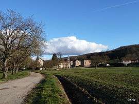
Montfalcon is a commune in the Isère department in southeastern France.
Geography
The village lies on the left bank of the Galaure, which flows west through the southern part of the commune.
Population
| Historical population | ||
|---|---|---|
| Year | Pop. | ±% |
| 1962 | 94 | — |
| 1968 | 112 | +19.1% |
| 1975 | 102 | −8.9% |
| 1982 | 125 | +22.5% |
| 1990 | 103 | −17.6% |
| 1999 | 99 | −3.9% |
| 2006 | 123 | +24.2% |
| 2011 | 123 | +0.0% |
See also
References
| Wikimedia Commons has media related to Montfalcon. |
This article is issued from Wikipedia - version of the 2/12/2016. The text is available under the Creative Commons Attribution/Share Alike but additional terms may apply for the media files.