Longlaville
| Longlaville | ||
|---|---|---|
|
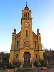
St. Laurentius' church | ||
| ||
 Longlaville | ||
|
Location within Grand Est region  Longlaville | ||
| Coordinates: 49°32′06″N 5°47′57″E / 49.535°N 5.7992°ECoordinates: 49°32′06″N 5°47′57″E / 49.535°N 5.7992°E | ||
| Country | France | |
| Region | Grand Est | |
| Department | Meurthe-et-Moselle | |
| Arrondissement | Briey | |
| Canton | Herserange | |
| Intercommunality | Communauté de communes de l'agglomération de Longwy | |
| Government | ||
| • Mayor (2008–2014) | Roger Corbellotti | |
| Area1 | 3.17 km2 (1.22 sq mi) | |
| Population (1999)2 | 2,377 | |
| • Density | 750/km2 (1,900/sq mi) | |
| • Urban | 4,504 | |
| Time zone | CET (UTC+1) | |
| • Summer (DST) | CEST (UTC+2) | |
| INSEE/Postal code | 54321 / 54810 | |
| Elevation |
255–391 m (837–1,283 ft) (avg. 248 m or 814 ft) | |
|
1 French Land Register data, which excludes lakes, ponds, glaciers > 1 km² (0.386 sq mi or 247 acres) and river estuaries. 2 Population without double counting: residents of multiple communes (e.g., students and military personnel) only counted once. | ||

Longlaville (Luxembourgish: Longsduerf) is a commune in the Meurthe-et-Moselle department in north-eastern France.
See also
| Wikimedia Commons has media related to Longlaville. |
This article is issued from Wikipedia - version of the 3/15/2016. The text is available under the Creative Commons Attribution/Share Alike but additional terms may apply for the media files.