Magny-lès-Aubigny
| Magny-lès-Aubigny | |
|---|---|
|
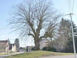
Linden tree | |
 Magny-lès-Aubigny | |
|
Location within Bourgogne-Franche-Comté region  Magny-lès-Aubigny | |
| Coordinates: 47°06′43″N 5°10′38″E / 47.1119°N 5.1772°E / 47.1119; 5.1772Coordinates: 47°06′43″N 5°10′38″E / 47.1119°N 5.1772°E / 47.1119; 5.1772 | |
| Country | France |
| Region | Bourgogne-Franche-Comté |
| Department | Côte-d'Or |
| Arrondissement | Beaune |
| Canton | Saint-Jean-de-Losne |
| Intercommunality | Rives de Saône |
| Government | |
| • Mayor (2008–2014) | Rémy Marpeaux |
| Area1 | 6.99 km2 (2.70 sq mi) |
| Population (2008)2 | 197 |
| • Density | 28/km2 (73/sq mi) |
| Time zone | CET (UTC+1) |
| • Summer (DST) | CEST (UTC+2) |
| INSEE/Postal code | 21366 / 21170 |
| Elevation |
182–209 m (597–686 ft) (avg. 199 m or 653 ft) |
|
1 French Land Register data, which excludes lakes, ponds, glaciers > 1 km² (0.386 sq mi or 247 acres) and river estuaries. 2 Population without double counting: residents of multiple communes (e.g., students and military personnel) only counted once. | |
Magny-lès-Aubigny is a commune in the Côte-d'Or department in eastern France.
Population
| Historical population | ||
|---|---|---|
| Year | Pop. | ±% |
| 1962 | 134 | — |
| 1968 | 163 | +21.6% |
| 1975 | 150 | −8.0% |
| 1982 | 159 | +6.0% |
| 1990 | 182 | +14.5% |
| 1999 | 195 | +7.1% |
| 2008 | 197 | +1.0% |
See also
References
| Wikimedia Commons has media related to Magny-lès-Aubigny. |
This article is issued from Wikipedia - version of the 7/16/2016. The text is available under the Creative Commons Attribution/Share Alike but additional terms may apply for the media files.