Vic-sous-Thil
| Vic-sous-Thil | |
|---|---|
 | |
 Vic-sous-Thil | |
|
Location within Bourgogne-Franche-Comté region  Vic-sous-Thil | |
| Coordinates: 47°22′15″N 4°18′37″E / 47.3708°N 4.3103°E / 47.3708; 4.3103Coordinates: 47°22′15″N 4°18′37″E / 47.3708°N 4.3103°E / 47.3708; 4.3103 | |
| Country | France |
| Region | Bourgogne-Franche-Comté |
| Department | Côte-d'Or |
| Arrondissement | Montbard |
| Canton | Précy-sous-Thil |
| Government | |
| • Mayor (2008–2014) | Raymond Machureau |
| Area1 | 21.34 km2 (8.24 sq mi) |
| Population (2008)2 | 205 |
| • Density | 9.6/km2 (25/sq mi) |
| Time zone | CET (UTC+1) |
| • Summer (DST) | CEST (UTC+2) |
| INSEE/Postal code | 21678 / 21390 |
| Elevation | 318–493 m (1,043–1,617 ft) |
|
1 French Land Register data, which excludes lakes, ponds, glaciers > 1 km² (0.386 sq mi or 247 acres) and river estuaries. 2 Population without double counting: residents of multiple communes (e.g., students and military personnel) only counted once. | |
Vic-sous-Thil is a commune in the Côte-d'Or département in eastern France.
Population
| Historical population | ||
|---|---|---|
| Year | Pop. | ±% |
| 1962 | 216 | — |
| 1968 | 233 | +7.9% |
| 1975 | 203 | −12.9% |
| 1982 | 208 | +2.5% |
| 1990 | 209 | +0.5% |
| 1999 | 203 | −2.9% |
| 2008 | 205 | +1.0% |
Sights
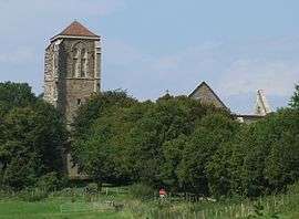
- Château de Thil, ruined mediaeval castle, listed since 1905 as a historic site by the French Ministry of Culture.[1]
See also
References
- ↑ Ministry of Culture: Château de Thil (ruines) (French)
| Wikimedia Commons has media related to Vic-sous-Thil. |
This article is issued from Wikipedia - version of the 7/21/2016. The text is available under the Creative Commons Attribution/Share Alike but additional terms may apply for the media files.