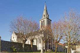
Chaignay
| Chaignay | ||
|---|---|---|
 | ||
| ||
 Chaignay | ||
|
Location within Bourgogne-Franche-Comté region  Chaignay | ||
| Coordinates: 47°28′39″N 5°04′16″E / 47.4775°N 5.0711°E / 47.4775; 5.0711Coordinates: 47°28′39″N 5°04′16″E / 47.4775°N 5.0711°E / 47.4775; 5.0711 | ||
| Country | France | |
| Region | Bourgogne-Franche-Comté | |
| Department | Côte-d'Or | |
| Arrondissement | Dijon | |
| Canton | Is-sur-Tille | |
| Intercommunality | COVATI | |
| Government | ||
| • Mayor (2008–2014) | Jean-Marie Michelin | |
| Area1 | 25.05 km2 (9.67 sq mi) | |
| Population (2008)2 | 498 | |
| • Density | 20/km2 (51/sq mi) | |
| Time zone | CET (UTC+1) | |
| • Summer (DST) | CEST (UTC+2) | |
| INSEE/Postal code | 21127 / 21120 | |
| Elevation |
282–536 m (925–1,759 ft) (avg. 365 m or 1,198 ft) | |
|
1 French Land Register data, which excludes lakes, ponds, glaciers > 1 km² (0.386 sq mi or 247 acres) and river estuaries. 2 Population without double counting: residents of multiple communes (e.g., students and military personnel) only counted once. | ||
.svg.png)
Chaignay is a commune in the Côte-d'Or department in eastern France.
Population
| Historical population | ||
|---|---|---|
| Year | Pop. | ±% |
| 1962 | 290 | — |
| 1968 | 310 | +6.9% |
| 1975 | 311 | +0.3% |
| 1982 | 336 | +8.0% |
| 1990 | 369 | +9.8% |
| 1999 | 430 | +16.5% |
| 2008 | 498 | +15.8% |
See also
References
| Wikimedia Commons has media related to Chaignay. |
This article is issued from Wikipedia - version of the 3/1/2016. The text is available under the Creative Commons Attribution/Share Alike but additional terms may apply for the media files.