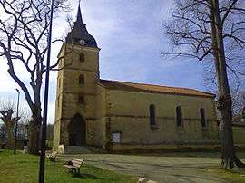
Ladevèze-Rivière
| Ladevèze-Rivière | ||
|---|---|---|
 | ||
| ||
 Ladevèze-Rivière | ||
|
Location within Occitanie region  Ladevèze-Rivière | ||
| Coordinates: 43°33′10″N 0°04′28″E / 43.5528°N 0.0744°ECoordinates: 43°33′10″N 0°04′28″E / 43.5528°N 0.0744°E | ||
| Country | France | |
| Region | Occitanie | |
| Department | Gers | |
| Arrondissement | Mirande | |
| Canton | Marciac | |
| Intercommunality | Bastides et vallons du Gers | |
| Government | ||
| • Mayor (2008–2014) | Cyril Cotonat | |
| Area1 | 13.54 km2 (5.23 sq mi) | |
| Population (2008)2 | 221 | |
| • Density | 16/km2 (42/sq mi) | |
| Time zone | CET (UTC+1) | |
| • Summer (DST) | CEST (UTC+2) | |
| INSEE/Postal code | 32174 / 32230 | |
| Elevation |
134–220 m (440–722 ft) (avg. 150 m or 490 ft) | |
|
1 French Land Register data, which excludes lakes, ponds, glaciers > 1 km² (0.386 sq mi or 247 acres) and river estuaries. 2 Population without double counting: residents of multiple communes (e.g., students and military personnel) only counted once. | ||
.svg.png)
Ladevèze-Rivière is a commune in the Gers department in southwestern France.
Geography
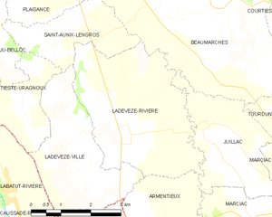
Ladevèze-Rivière and its surrounding communes
Population
| Historical population | ||
|---|---|---|
| Year | Pop. | ±% |
| 1962 | 308 | — |
| 1968 | 313 | +1.6% |
| 1975 | 285 | −8.9% |
| 1982 | 261 | −8.4% |
| 1990 | 245 | −6.1% |
| 1999 | 223 | −9.0% |
| 2008 | 221 | −0.9% |
See also
References
| Wikimedia Commons has media related to Ladevèze-Rivière. |
This article is issued from Wikipedia - version of the 5/6/2016. The text is available under the Creative Commons Attribution/Share Alike but additional terms may apply for the media files.