Barcugnan
| Barcugnan | |
|---|---|
 Barcugnan | |
|
Location within Occitanie region  Barcugnan | |
| Coordinates: 43°22′47″N 0°24′25″E / 43.3797°N 0.4069°ECoordinates: 43°22′47″N 0°24′25″E / 43.3797°N 0.4069°E | |
| Country | France |
| Region | Occitanie |
| Department | Gers |
| Arrondissement | Mirande |
| Canton | Miélan |
| Intercommunality | Hautes vallées de Gascogne |
| Government | |
| • Mayor (2008–2014) | Robert Betbeze |
| Area1 | 9.11 km2 (3.52 sq mi) |
| Population (2008)2 | 139 |
| • Density | 15/km2 (40/sq mi) |
| Time zone | CET (UTC+1) |
| • Summer (DST) | CEST (UTC+2) |
| INSEE/Postal code | 32028 / 32170 |
| Elevation | 190–311 m (623–1,020 ft) |
|
1 French Land Register data, which excludes lakes, ponds, glaciers > 1 km² (0.386 sq mi or 247 acres) and river estuaries. 2 Population without double counting: residents of multiple communes (e.g., students and military personnel) only counted once. | |
Barcugnan is a commune in the Gers department in southwestern France.
Geography
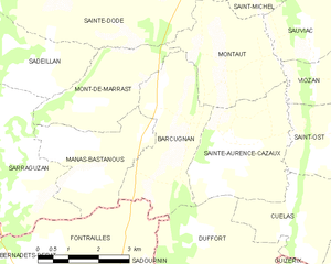
Barcugnan and its surrounding communes
Population
| Historical population | ||
|---|---|---|
| Year | Pop. | ±% |
| 1803 | 385 | — |
| 1818 | 532 | +38.2% |
| 1846 | 610 | +14.7% |
| 1896 | 420 | −31.1% |
| 1912 | 377 | −10.2% |
| 1947 | 296 | −21.5% |
| 1962 | 260 | −12.2% |
| 1968 | 228 | −12.3% |
| 1975 | 192 | −15.8% |
| 1982 | 169 | −12.0% |
| 1990 | 164 | −3.0% |
| 1999 | 143 | −12.8% |
| 2008 | 139 | −2.8% |
See also
References
| Wikimedia Commons has media related to Barcugnan. |
This article is issued from Wikipedia - version of the 7/21/2016. The text is available under the Creative Commons Attribution/Share Alike but additional terms may apply for the media files.