Eancé
| Eancé Aentieg | ||
|---|---|---|
|
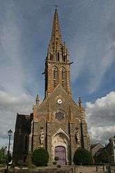
The church of Saint-Martin | ||
| ||
 Eancé | ||
|
Location within Brittany region 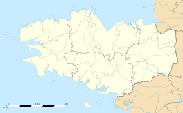 Eancé | ||
| Coordinates: 47°49′21″N 1°14′30″W / 47.8225°N 1.2417°WCoordinates: 47°49′21″N 1°14′30″W / 47.8225°N 1.2417°W | ||
| Country | France | |
| Region | Brittany | |
| Department | Ille-et-Vilaine | |
| Arrondissement | Fougères-Vitré | |
| Canton | La Guerche-de-Bretagne | |
| Intercommunality | Pays de la Roche-aux-Fées | |
| Government | ||
| • Mayor (2014–2020) | Henri Valais | |
| Area1 | 16.50 km2 (6.37 sq mi) | |
| Population (2008)2 | 385 | |
| • Density | 23/km2 (60/sq mi) | |
| Time zone | CET (UTC+1) | |
| • Summer (DST) | CEST (UTC+2) | |
| INSEE/Postal code | 35103 / 35640 | |
| Elevation | 61–112 m (200–367 ft) | |
|
1 French Land Register data, which excludes lakes, ponds, glaciers > 1 km² (0.386 sq mi or 247 acres) and river estuaries. 2 Population without double counting: residents of multiple communes (e.g., students and military personnel) only counted once. | ||

Eancé (Breton: Aentieg) is a commune in the Ille-et-Vilaine department in Brittany in northwestern France.
Geography
The river Semnon flows northwest through the commune.
Population
Inhabitants of Eancé are called Éancéens in French.
| Historical population | ||
|---|---|---|
| Year | Pop. | ±% |
| 1962 | 502 | — |
| 1968 | 568 | +13.1% |
| 1975 | 466 | −18.0% |
| 1982 | 387 | −17.0% |
| 1990 | 336 | −13.2% |
| 1999 | 338 | +0.6% |
| 2008 | 385 | +13.9% |
See also
References
External links
| Wikimedia Commons has media related to Eancé. |
This article is issued from Wikipedia - version of the 9/3/2015. The text is available under the Creative Commons Attribution/Share Alike but additional terms may apply for the media files.