Grand-Fougeray
| Grand-Fougeray Felgerieg-Veur | ||
|---|---|---|
|
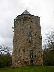
Tower of the old chateau | ||
| ||
 Grand-Fougeray | ||
|
Location within Brittany region 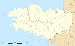 Grand-Fougeray | ||
| Coordinates: 47°43′26″N 1°43′55″W / 47.7239°N 1.7319°WCoordinates: 47°43′26″N 1°43′55″W / 47.7239°N 1.7319°W | ||
| Country | France | |
| Region | Brittany | |
| Department | Ille-et-Vilaine | |
| Arrondissement | Redon | |
| Canton | Grand-Fougeray | |
| Intercommunality | Pays de Grand-Fougeray | |
| Government | ||
| • Mayor (2014–2020) | Alain David | |
| Area1 | 55.42 km2 (21.40 sq mi) | |
| Population (2008)2 | 2,321 | |
| • Density | 42/km2 (110/sq mi) | |
| Time zone | CET (UTC+1) | |
| • Summer (DST) | CEST (UTC+2) | |
| INSEE/Postal code | 35124 / 35390 | |
| Elevation | 3–92 m (9.8–301.8 ft) | |
|
1 French Land Register data, which excludes lakes, ponds, glaciers > 1 km² (0.386 sq mi or 247 acres) and river estuaries. 2 Population without double counting: residents of multiple communes (e.g., students and military personnel) only counted once. | ||
.svg.png)
Grand-Fougeray (Breton: Felgerieg-Veur) is a commune in the Ille-et-Vilaine department of Brittany in north-western France.
Geography
The river Chère forms most of the commune's southern border.
Population
Inhabitants of Grand-Fougeray are called Fulkériens in French.
| Historical population | ||
|---|---|---|
| Year | Pop. | ±% |
| 1962 | 2,127 | — |
| 1968 | 2,219 | +4.3% |
| 1975 | 2,008 | −9.5% |
| 1982 | 2,032 | +1.2% |
| 1990 | 1,995 | −1.8% |
| 1999 | 1,970 | −1.3% |
| 2008 | 2,321 | +17.8% |
See also
References
External links
| Wikimedia Commons has media related to Grand-Fougeray. |
This article is issued from Wikipedia - version of the 11/12/2014. The text is available under the Creative Commons Attribution/Share Alike but additional terms may apply for the media files.