Langouet
| Langouet Langouët | |
|---|---|
|
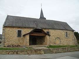
Saint-Armel church | |
 Langouet | |
|
Location within Brittany region 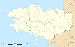 Langouet | |
| Coordinates: 48°15′02″N 1°49′19″W / 48.2506°N 1.8219°WCoordinates: 48°15′02″N 1°49′19″W / 48.2506°N 1.8219°W | |
| Country | France |
| Region | Brittany |
| Department | Ille-et-Vilaine |
| Arrondissement | Rennes |
| Canton | Hédé |
| Intercommunality | Val d'Ille |
| Government | |
| • Mayor (2014–2020) | Daniel Cueff |
| Area1 | 6.99 km2 (2.70 sq mi) |
| Population (2009)2 | 553 |
| • Density | 79/km2 (200/sq mi) |
| Time zone | CET (UTC+1) |
| • Summer (DST) | CEST (UTC+2) |
| INSEE/Postal code | 35146 / 35630 |
| Elevation | 71–121 m (233–397 ft) |
|
1 French Land Register data, which excludes lakes, ponds, glaciers > 1 km² (0.386 sq mi or 247 acres) and river estuaries. 2 Population without double counting: residents of multiple communes (e.g., students and military personnel) only counted once. | |
Langouet (Breton: Langoed) is a commune in the Ille-et-Vilaine department of Brittany in northwestern France.
Population
Inhabitants of Langouet are called Langouëtiens in French.
| Historical population | ||
|---|---|---|
| Year | Pop. | ±% |
| 1962 | 257 | — |
| 1968 | 278 | +8.2% |
| 1975 | 317 | +14.0% |
| 1982 | 418 | +31.9% |
| 1990 | 454 | +8.6% |
| 1999 | 537 | +18.3% |
| 2008 | 553 | +3.0% |
See also
References
External links
| Wikimedia Commons has media related to Langouët. |
- Mayors of Ille-et-Vilaine Association (French);
- French Ministry of Culture list for Langouet (French)
This article is issued from Wikipedia - version of the 11/12/2014. The text is available under the Creative Commons Attribution/Share Alike but additional terms may apply for the media files.