La Chapelle-Thouarault
| La Chapelle-Thouarault Bredual | ||
|---|---|---|
|
The parish church of Notre-Dame-de-Montual | ||
| ||
 La Chapelle-Thouarault | ||
|
Location within Brittany region 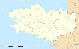 La Chapelle-Thouarault | ||
| Coordinates: 48°07′30″N 1°51′50″W / 48.1250°N 1.8639°WCoordinates: 48°07′30″N 1°51′50″W / 48.1250°N 1.8639°W | ||
| Country | France | |
| Region | Brittany | |
| Department | Ille-et-Vilaine | |
| Arrondissement | Rennes | |
| Canton | Montfort-sur-Meu | |
| Intercommunality | Rennes Métropole | |
| Government | ||
| • Mayor (2014–2020) | Jean-François Bohuon | |
| Area1 | 7.64 km2 (2.95 sq mi) | |
| Population (2008)2 | 1,931 | |
| • Density | 250/km2 (650/sq mi) | |
| Time zone | CET (UTC+1) | |
| • Summer (DST) | CEST (UTC+2) | |
| INSEE/Postal code | 35065 / 35590 | |
| Elevation | 28–64 m (92–210 ft) | |
|
1 French Land Register data, which excludes lakes, ponds, glaciers > 1 km² (0.386 sq mi or 247 acres) and river estuaries. 2 Population without double counting: residents of multiple communes (e.g., students and military personnel) only counted once. | ||
_%C3%89glise_01.jpg)

La Chapelle-Thouarault (Breton: Bredual) is a commune in the Ille-et-Vilaine department of Brittany in north-western France.
Population
| Historical population | ||
|---|---|---|
| Year | Pop. | ±% |
| 1793 | 499 | — |
| 1856 | 569 | +14.0% |
| 1906 | 541 | −4.9% |
| 1946 | 458 | −15.3% |
| 1962 | 419 | −8.5% |
| 1968 | 451 | +7.6% |
| 1975 | 792 | +75.6% |
| 1982 | 1,566 | +97.7% |
| 1990 | 1,975 | +26.1% |
| 1999 | 1,915 | −3.0% |
| 2008 | 1,931 | +0.8% |
See also
References
External links
| Wikimedia Commons has media related to La Chapelle-Thouarault. |
This article is issued from Wikipedia - version of the 9/3/2015. The text is available under the Creative Commons Attribution/Share Alike but additional terms may apply for the media files.