Rouffiac, Charente-Maritime
| Rouffiac | ||
|---|---|---|
|
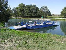
Ferry on the Charente | ||
| ||
 Rouffiac | ||
|
Location within Nouvelle-Aquitaine region  Rouffiac | ||
| Coordinates: 45°41′12″N 0°29′21″W / 45.6867°N 0.4892°WCoordinates: 45°41′12″N 0°29′21″W / 45.6867°N 0.4892°W | ||
| Country | France | |
| Region | Nouvelle-Aquitaine | |
| Department | Charente-Maritime | |
| Arrondissement | Saintes | |
| Canton | Pons | |
| Intercommunality | Haute-Saintonge | |
| Government | ||
| • Mayor (2008–2014) | Julien Tissandier | |
| Area1 | 5.85 km2 (2.26 sq mi) | |
| Population (2008)2 | 442 | |
| • Density | 76/km2 (200/sq mi) | |
| Time zone | CET (UTC+1) | |
| • Summer (DST) | CEST (UTC+2) | |
| INSEE/Postal code | 17304 / 17800 | |
| Elevation | 2–27 m (6.6–88.6 ft) | |
|
1 French Land Register data, which excludes lakes, ponds, glaciers > 1 km² (0.386 sq mi or 247 acres) and river estuaries. 2 Population without double counting: residents of multiple communes (e.g., students and military personnel) only counted once. | ||

Rouffiac is a commune in the Charente-Maritime department in southwestern France.
Population
| Historical population | ||
|---|---|---|
| Year | Pop. | ±% |
| 1806 | 398 | — |
| 1820 | 571 | +43.5% |
| 1876 | 526 | −7.9% |
| 1901 | 507 | −3.6% |
| 1911 | 410 | −19.1% |
| 1921 | 361 | −12.0% |
| 1936 | 333 | −7.8% |
| 1946 | 354 | +6.3% |
| 1954 | 344 | −2.8% |
| 1962 | 324 | −5.8% |
| 1968 | 364 | +12.3% |
| 1975 | 396 | +8.8% |
| 1982 | 359 | −9.3% |
| 1990 | 352 | −1.9% |
| 1999 | 327 | −7.1% |
| 2008 | 442 | +35.2% |
See also
References
| Wikimedia Commons has media related to Rouffiac (Charente-Maritime). |
This article is issued from Wikipedia - version of the 3/15/2016. The text is available under the Creative Commons Attribution/Share Alike but additional terms may apply for the media files.