Lorignac
| Lorignac | |
|---|---|
|
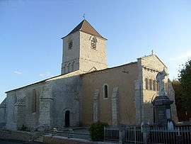
Romanesque church | |
 Lorignac | |
|
Location within Nouvelle-Aquitaine region  Lorignac | |
| Coordinates: 45°27′21″N 0°41′23″W / 45.4558°N 0.6897°WCoordinates: 45°27′21″N 0°41′23″W / 45.4558°N 0.6897°W | |
| Country | France |
| Region | Nouvelle-Aquitaine |
| Department | Charente-Maritime |
| Arrondissement | Jonzac |
| Canton | Saint-Genis-de-Saintonge |
| Intercommunality | Haute-Saintonge |
| Government | |
| • Mayor (2008–2014) | Évrard Garnier |
| Area1 | 17.53 km2 (6.77 sq mi) |
| Population (2008)2 | 462 |
| • Density | 26/km2 (68/sq mi) |
| Time zone | CET (UTC+1) |
| • Summer (DST) | CEST (UTC+2) |
| INSEE/Postal code | 17210 / 17240 |
| Elevation | 7–61 m (23–200 ft) |
|
1 French Land Register data, which excludes lakes, ponds, glaciers > 1 km² (0.386 sq mi or 247 acres) and river estuaries. 2 Population without double counting: residents of multiple communes (e.g., students and military personnel) only counted once. | |
Lorignac is a commune in the Charente-Maritime department in southwestern France.
Population
| Historical population | ||
|---|---|---|
| Year | Pop. | ±% |
| 1962 | 749 | — |
| 1968 | 718 | −4.1% |
| 1975 | 640 | −10.9% |
| 1982 | 584 | −8.8% |
| 1990 | 534 | −8.6% |
| 1999 | 447 | −16.3% |
| 2008 | 462 | +3.4% |
See also
References
| Wikimedia Commons has media related to Lorignac. |
This article is issued from Wikipedia - version of the 3/4/2013. The text is available under the Creative Commons Attribution/Share Alike but additional terms may apply for the media files.