Le Douhet
| Le Douhet | |
|---|---|
 | |
 Le Douhet | |
|
Location within Nouvelle-Aquitaine region  Le Douhet | |
| Coordinates: 45°49′13″N 0°34′11″W / 45.8203°N 0.5697°WCoordinates: 45°49′13″N 0°34′11″W / 45.8203°N 0.5697°W | |
| Country | France |
| Region | Nouvelle-Aquitaine |
| Department | Charente-Maritime |
| Arrondissement | Saintes |
| Canton | Saintes-Nord |
| Intercommunality | Pays Santon |
| Government | |
| • Mayor (2001–2008) | Jacques Tanner |
| Area1 | 18.35 km2 (7.08 sq mi) |
| Population (2008)2 | 704 |
| • Density | 38/km2 (99/sq mi) |
| Time zone | CET (UTC+1) |
| • Summer (DST) | CEST (UTC+2) |
| INSEE/Postal code | 17143 / 17100 |
| Elevation |
12–81 m (39–266 ft) (avg. 64 m or 210 ft) |
|
1 French Land Register data, which excludes lakes, ponds, glaciers > 1 km² (0.386 sq mi or 247 acres) and river estuaries. 2 Population without double counting: residents of multiple communes (e.g., students and military personnel) only counted once. | |
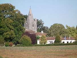
Le Douhet is a commune in the Charente-Maritime department in southwestern France.
Population
| Historical population | ||
|---|---|---|
| Year | Pop. | ±% |
| 1962 | 511 | — |
| 1968 | 502 | −1.8% |
| 1975 | 477 | −5.0% |
| 1982 | 518 | +8.6% |
| 1990 | 589 | +13.7% |
| 1999 | 636 | +8.0% |
| 2008 | 704 | +10.7% |
See also
References
| Wikimedia Commons has media related to Le Douhet. |
This article is issued from Wikipedia - version of the 3/2/2013. The text is available under the Creative Commons Attribution/Share Alike but additional terms may apply for the media files.