Bourcefranc-le-Chapus
| Bourcefranc-le-Chapus | |
|---|---|
|
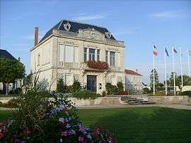
The town hall. | |
 Bourcefranc-le-Chapus | |
|
Location within Nouvelle-Aquitaine region  Bourcefranc-le-Chapus | |
| Coordinates: 45°50′50″N 1°08′51″W / 45.8472°N 1.1475°WCoordinates: 45°50′50″N 1°08′51″W / 45.8472°N 1.1475°W | |
| Country | France |
| Region | Nouvelle-Aquitaine |
| Department | Charente-Maritime |
| Arrondissement | Rochefort |
| Canton | Marennes |
| Intercommunality | Bassin de Marennes |
| Government | |
| • Mayor (2008–2014) | Jean-Luc Rousseau |
| Area1 | 12.40 km2 (4.79 sq mi) |
| Population (2008)2 | 3,347 |
| • Density | 270/km2 (700/sq mi) |
| Time zone | CET (UTC+1) |
| • Summer (DST) | CEST (UTC+2) |
| INSEE/Postal code | 17058 / 17560 |
| Elevation | 0–18 m (0–59 ft) |
|
1 French Land Register data, which excludes lakes, ponds, glaciers > 1 km² (0.386 sq mi or 247 acres) and river estuaries. 2 Population without double counting: residents of multiple communes (e.g., students and military personnel) only counted once. | |
Bourcefranc-le-Chapus is a commune in the Charente-Maritime department in the Nouvelle-Aquitaine region in southwestern France. Bourcefranc-le-Chapus is a major oyster farming port. Fort Louvois is a fortification built by Vauban on the Chapus islet in front of the town.
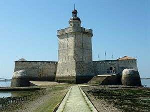
Fort Louvois.
Population
| Historical population | ||
|---|---|---|
| Year | Pop. | ±% |
| 1911 | 2,152 | — |
| 1921 | 2,184 | +1.5% |
| 1926 | 2,401 | +9.9% |
| 1931 | 2,522 | +5.0% |
| 1936 | 2,763 | +9.6% |
| 1946 | 2,842 | +2.9% |
| 1954 | 2,878 | +1.3% |
| 1962 | 3,073 | +6.8% |
| 1968 | 3,095 | +0.7% |
| 1975 | 2,984 | −3.6% |
| 1982 | 2,794 | −6.4% |
| 1990 | 2,851 | +2.0% |
| 1999 | 2,951 | +3.5% |
| 2008 | 3,347 | +13.4% |
See also
References
External links
| Wikimedia Commons has media related to Bourcefranc-le-Chapus. |
This article is issued from Wikipedia - version of the 11/11/2016. The text is available under the Creative Commons Attribution/Share Alike but additional terms may apply for the media files.