La Jard
| La Jard | |
|---|---|
 | |
 La Jard | |
|
Location within Nouvelle-Aquitaine region  La Jard | |
| Coordinates: 45°39′19″N 0°35′05″W / 45.6553°N 0.5847°WCoordinates: 45°39′19″N 0°35′05″W / 45.6553°N 0.5847°W | |
| Country | France |
| Region | Nouvelle-Aquitaine |
| Department | Charente-Maritime |
| Arrondissement | Saintes |
| Canton | Saintes-Est |
| Intercommunality | Pays Santon |
| Government | |
| • Mayor (2008–2014) | Bernard Grenon |
| Area1 | 8.48 km2 (3.27 sq mi) |
| Population (2008)2 | 310 |
| • Density | 37/km2 (95/sq mi) |
| Time zone | CET (UTC+1) |
| • Summer (DST) | CEST (UTC+2) |
| INSEE/Postal code | 17191 / 17460 |
| Elevation |
6–48 m (20–157 ft) (avg. 40 m or 130 ft) |
|
1 French Land Register data, which excludes lakes, ponds, glaciers > 1 km² (0.386 sq mi or 247 acres) and river estuaries. 2 Population without double counting: residents of multiple communes (e.g., students and military personnel) only counted once. | |
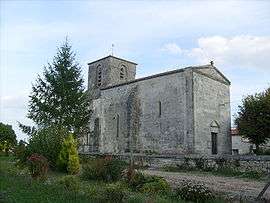
La Jard is a commune in the Charente-Maritime department in southwestern France.
Population
| Historical population | ||
|---|---|---|
| Year | Pop. | ±% |
| 1962 | 223 | — |
| 1968 | 237 | +6.3% |
| 1975 | 207 | −12.7% |
| 1982 | 198 | −4.3% |
| 1990 | 259 | +30.8% |
| 1999 | 275 | +6.2% |
| 2008 | 310 | +12.7% |
Geography
The river Seugne forms most of the commune's northeastern border.
See also
References
| Wikimedia Commons has media related to La Jard. |
This article is issued from Wikipedia - version of the 3/4/2013. The text is available under the Creative Commons Attribution/Share Alike but additional terms may apply for the media files.