Lézignan-la-Cèbe
| Lézignan-la-Cèbe | ||
|---|---|---|
|
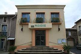
Town hall | ||
| ||
 Lézignan-la-Cèbe | ||
|
Location within Occitanie region  Lézignan-la-Cèbe | ||
| Coordinates: 43°29′38″N 3°26′16″E / 43.4939°N 3.4378°ECoordinates: 43°29′38″N 3°26′16″E / 43.4939°N 3.4378°E | ||
| Country | France | |
| Region | Occitanie | |
| Department | Hérault | |
| Arrondissement | Béziers | |
| Canton | Montagnac | |
| Intercommunality | Hérault Méditerranée | |
| Government | ||
| • Mayor (2008–2014) | Jean-Noël Landry | |
| Area1 | 6.13 km2 (2.37 sq mi) | |
| Population (2008)2 | 1,317 | |
| • Density | 210/km2 (560/sq mi) | |
| Time zone | CET (UTC+1) | |
| • Summer (DST) | CEST (UTC+2) | |
| INSEE/Postal code | 34136 / 34120 | |
| Elevation | 7–91 m (23–299 ft) | |
|
1 French Land Register data, which excludes lakes, ponds, glaciers > 1 km² (0.386 sq mi or 247 acres) and river estuaries. 2 Population without double counting: residents of multiple communes (e.g., students and military personnel) only counted once. | ||
.svg.png)
Lézignan-la-Cèbe is a commune in the Hérault département in the Occitanie region in southern France.
Population
| Historical population | ||
|---|---|---|
| Year | Pop. | ±% |
| 1780 | 497 | — |
| 1804 | 544 | +9.5% |
| 1820 | 568 | +4.4% |
| 1831 | 648 | +14.1% |
| 1840 | 656 | +1.2% |
| 1861 | 648 | −1.2% |
| 1877 | 701 | +8.2% |
| 1891 | 818 | +16.7% |
| 1921 | 926 | +13.2% |
| 1931 | 967 | +4.4% |
| 1946 | 736 | −23.9% |
| 1962 | 705 | −4.2% |
| 1968 | 736 | +4.4% |
| 1975 | 712 | −3.3% |
| 1982 | 838 | +17.7% |
| 1990 | 977 | +16.6% |
| 1999 | 1,013 | +3.7% |
| 2008 | 1,317 | +30.0% |
See also
References
| Wikimedia Commons has media related to Lézignan-la-Cèbe. |
This article is issued from Wikipedia - version of the 11/12/2016. The text is available under the Creative Commons Attribution/Share Alike but additional terms may apply for the media files.