Tourbes
| Tourbes | ||
|---|---|---|
|
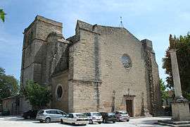
The church of Tourbes | ||
| ||
 Tourbes | ||
|
Location within Occitanie region  Tourbes | ||
| Coordinates: 43°26′48″N 3°22′46″E / 43.4467°N 3.3794°ECoordinates: 43°26′48″N 3°22′46″E / 43.4467°N 3.3794°E | ||
| Country | France | |
| Region | Occitanie | |
| Department | Hérault | |
| Arrondissement | Béziers | |
| Canton | Pézenas | |
| Intercommunality | Pays de Thongue | |
| Government | ||
| • Mayor (2008–2014) | Christian Jantel | |
| Area1 | 15.96 km2 (6.16 sq mi) | |
| Population (2008)2 | 1,462 | |
| • Density | 92/km2 (240/sq mi) | |
| Time zone | CET (UTC+1) | |
| • Summer (DST) | CEST (UTC+2) | |
| INSEE/Postal code | 34311 / 34120 | |
| Elevation |
11–103 m (36–338 ft) (avg. 50 m or 160 ft) | |
|
1 French Land Register data, which excludes lakes, ponds, glaciers > 1 km² (0.386 sq mi or 247 acres) and river estuaries. 2 Population without double counting: residents of multiple communes (e.g., students and military personnel) only counted once. | ||
.svg.png)
Tourbes is a commune in the Hérault department in the Occitanie region in southern France.
Population
| Historical population | ||
|---|---|---|
| Year | Pop. | ±% |
| 1962 | 766 | — |
| 1968 | 767 | +0.1% |
| 1975 | 740 | −3.5% |
| 1982 | 833 | +12.6% |
| 1990 | 1,022 | +22.7% |
| 1999 | 1,276 | +24.9% |
| 2008 | 1,462 | +14.6% |
See also
References
| Wikimedia Commons has media related to Tourbes. |
This article is issued from Wikipedia - version of the 11/12/2016. The text is available under the Creative Commons Attribution/Share Alike but additional terms may apply for the media files.