Guzargues
| Guzargues | ||
|---|---|---|
|
The parish church of Saint-Michel in Guzargues | ||
| ||
 Guzargues | ||
|
Location within Occitanie region  Guzargues | ||
| Coordinates: 43°43′24″N 3°55′32″E / 43.7233°N 3.9256°ECoordinates: 43°43′24″N 3°55′32″E / 43.7233°N 3.9256°E | ||
| Country | France | |
| Region | Occitanie | |
| Department | Hérault | |
| Arrondissement | Montpellier | |
| Canton | Castries | |
| Intercommunality | Pic-Saint-Loup | |
| Government | ||
| • Mayor (2008–2014) | Pierre Antoine | |
| Area1 | 11.73 km2 (4.53 sq mi) | |
| Population (2008)2 | 423 | |
| • Density | 36/km2 (93/sq mi) | |
| Time zone | CET (UTC+1) | |
| • Summer (DST) | CEST (UTC+2) | |
| INSEE/Postal code | 34118 / 34820 | |
| Elevation |
80–209 m (262–686 ft) (avg. 97 m or 318 ft) | |
|
1 French Land Register data, which excludes lakes, ponds, glaciers > 1 km² (0.386 sq mi or 247 acres) and river estuaries. 2 Population without double counting: residents of multiple communes (e.g., students and military personnel) only counted once. | ||
_%C3%89glise_Saint-Michel_01.JPG)

Guzargues is a commune in the Hérault département in the Occitanie region in southern France.
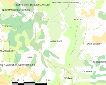
Map
Population
| Historical population | ||
|---|---|---|
| Year | Pop. | ±% |
| 1962 | 108 | — |
| 1968 | 116 | +7.4% |
| 1975 | 118 | +1.7% |
| 1982 | 149 | +26.3% |
| 1990 | 178 | +19.5% |
| 1999 | 344 | +93.3% |
| 2008 | 423 | +23.0% |
See also
References
| Wikimedia Commons has media related to Guzargues. |
This article is issued from Wikipedia - version of the 11/12/2016. The text is available under the Creative Commons Attribution/Share Alike but additional terms may apply for the media files.