Florensac
| Florensac | ||
|---|---|---|
|
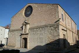
The church of St-Jean-Baptiste | ||
| ||
 Florensac | ||
|
Location within Occitanie region  Florensac | ||
| Coordinates: 43°23′01″N 3°27′56″E / 43.3836°N 3.4656°ECoordinates: 43°23′01″N 3°27′56″E / 43.3836°N 3.4656°E | ||
| Country | France | |
| Region | Occitanie | |
| Department | Hérault | |
| Arrondissement | Béziers | |
| Canton | Florensac | |
| Intercommunality | Hérault Méditerranée | |
| Government | ||
| • Mayor (2008–2014) | Vincent Gaudy | |
| Area1 | 36.9 km2 (14.2 sq mi) | |
| Population (2008)2 | 4,731 | |
| • Density | 130/km2 (330/sq mi) | |
| Time zone | CET (UTC+1) | |
| • Summer (DST) | CEST (UTC+2) | |
| INSEE/Postal code | 34101 / 34510 | |
| Elevation |
1–90 m (3.3–295.3 ft) (avg. 9 m or 30 ft) | |
|
1 French Land Register data, which excludes lakes, ponds, glaciers > 1 km² (0.386 sq mi or 247 acres) and river estuaries. 2 Population without double counting: residents of multiple communes (e.g., students and military personnel) only counted once. | ||
.svg.png)
Florensac is a commune in the Hérault department in southern France.
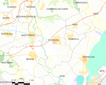
Map
Population
| Historical population | ||
|---|---|---|
| Year | Pop. | ±% |
| 1962 | 2,726 | — |
| 1968 | 2,785 | +2.2% |
| 1975 | 2,917 | +4.7% |
| 1982 | 3,064 | +5.0% |
| 1990 | 3,583 | +16.9% |
| 1999 | 3,859 | +7.7% |
| 2008 | 4,731 | +22.6% |
Images
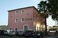 Town hall.
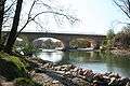 Bridge between Florensac and St. Thibéry.
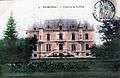 Florensac Castel build by baron Fernand de Vulliod.
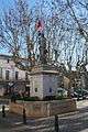 Statue of Marianne.
See also
References
| Wikimedia Commons has media related to Florensac. |
This article is issued from Wikipedia - version of the 3/15/2016. The text is available under the Creative Commons Attribution/Share Alike but additional terms may apply for the media files.